Cerro de las Cabezas
Cerro de las Cabezas is an archaeological site of Ibero-Oretani origin, located about 8 km south of the present-day city of Valdepeñas, in… Read more…


Add Cerro de las Cabezas to Your Trip
Create a detailed travel itinerary with smart routing, time estimates, and everything you need for a perfect trip.


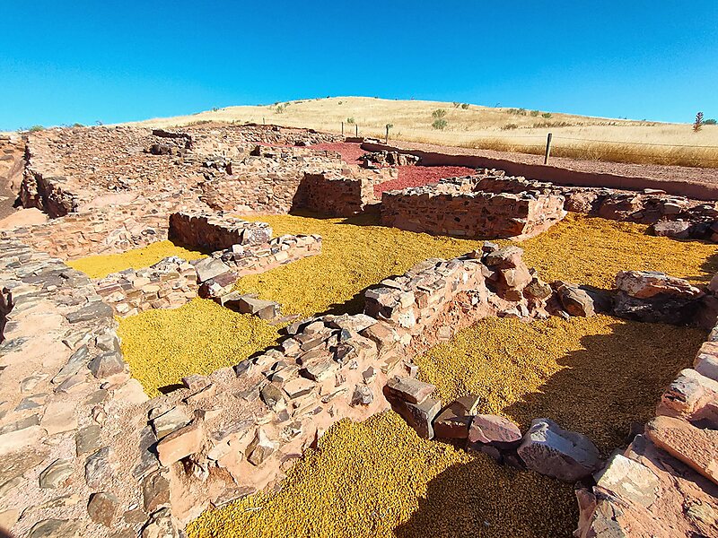
Cerro de las Cabezas is an archaeological site of Ibero-Oretani origin, located about 8 km south of the present-day city of Valdepeñas, in the province of Ciudad Real. The site is located on a hill approximately 800 metres high, and covers the area between the summit and the eastern slope, an area that has been partially destroyed by the construction of the Autovía A-4 that links Madrid with Andalusia.
The site was inhabited from the 6th to the 2nd century BC. Excavation began at the base of the hill. It is a walled city, of which the foundations of the houses and the plinths of the outer wall, made of large blocks of stone that fit perfectly together, have been preserved in their entirety. On top of these would have been the actual walls, made of adobe, which have now disappeared. The location of the site is due to strategic reasons for the control of the route between the Guadalquivir marshes, and therefore Andalusia, and the Meseta Sur.
Source: Wikipedia
More Information and Contact
Add Cerro de las Cabezas to Your Trip
Create a detailed travel itinerary with smart routing, time estimates, and everything you need for a perfect trip.