
Arco Metropolitano do Rio de Janeiro
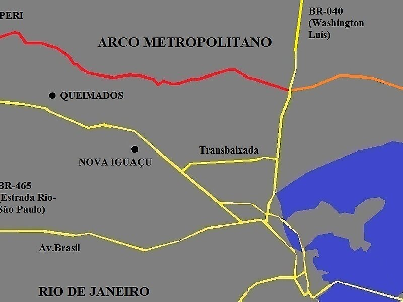
The Arco Metropolitano do Rio de Janeiro is a highway designed to connect the five main highways that cross the municipality of Rio de… Weiterlesen…


Arco Metropolitano do Rio de Janeiro – Zu deiner Reise hinzufügen
Erstelle eine detaillierte Reiseroute mit intelligenter Routenführung, Zeitabschätzungen und allem, was du für eine perfekte Reise brauchst.




The Arco Metropolitano do Rio de Janeiro is a highway designed to connect the five main highways that cross the municipality of Rio de Janeiro.
The project was divided in two stages. The first stretch of 71 km will link highways Washington Luís and Rio-Santos. It is budgeted at US$800 million and will initially be implemented in cooperation between the State Government of Rio de Janeiro and the DNIT.
When the project is completed the arch should reach a total of 145 km. Unlike Rodoanel Mário Covas in São Paulo, the Metropolitan Arch will not have a southern stretch, since it will initiate in both ends near a coastal area close to the Atlantic Ocean.
Source: Wikipedia
Weitere Informationen und Kontakt
Arco Metropolitano do Rio de Janeiro – Zu deiner Reise hinzufügen
Erstelle eine detaillierte Reiseroute mit intelligenter Routenführung, Zeitabschätzungen und allem, was du für eine perfekte Reise brauchst.