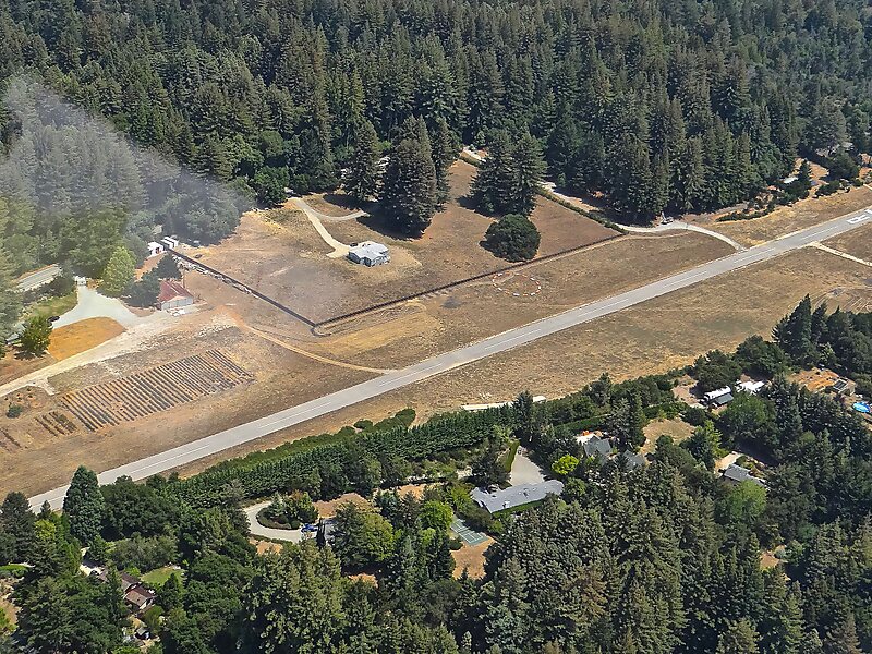
Bonny Doon Village Airport - FAA Identifier CL77, is a private, single-runway airport located 8 miles northwest of Santa Cruz, California at an elevation of 2020 feet in the mountain community of Bonny Doon. The airport has no air traffic control tower or other aviation services. Due to surrounding terrain, Runway 12 is used for departure with a usable length of 2400 feet. Runway 30 is used for landing and has a threshold displaced 390 ft. The traffic pattern altitude has been established at 1000 feet above ground level with a left turn landing pattern. The 35 foot wide asphalt runway is marked and well maintained. Although the field has a lighted windsock and non FAA compliant runway lighting, the airport is approved for day use only. Prior permission for use is required from the airport owner.
Download Download See moreWikipedia https://en.wikipedia.org/wiki/Bonny_Doon_Village_Airport
Address 8647 Empire Grade, 95060, United States
Coordinates 37°4'13.714" N -122°7'39.791" E