
Toutle River Sediment Retention Structure
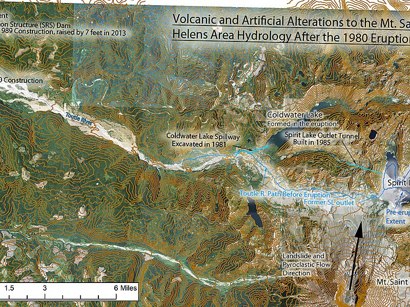
The Sediment Retention Structure is an earthen dam, 1,888 feet long and 184 feet high, on the North Fork Toutle River in the U.S. state of… Leer más…


Toutle River Sediment Retention Structure – Añadir a tu viaje
Crea un itinerario de viaje detallado con rutas inteligentes, estimaciones de tiempo y todo lo que necesitas para un viaje perfecto.




The Sediment Retention Structure is an earthen dam, 1,888 feet long and 184 feet high, on the North Fork Toutle River in the U.S. state of Washington. Completed by the United States Army Corps of Engineers in 1989, it is meant to prevent sediment from the 1980 eruption of Mount St. Helens from increasing flood risks along the Toutle and Cowlitz rivers.The Corps initially expected the basin behind the dam to be filled by 2035 with 258 million cubic yards of sediment.
Source: Wikipedia
Más información y contacto
Toutle River Sediment Retention Structure – Añadir a tu viaje
Crea un itinerario de viaje detallado con rutas inteligentes, estimaciones de tiempo y todo lo que necesitas para un viaje perfecto.