



Salzburger Kopf
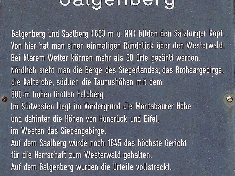
The Salzburger Kopf, at a height of 654.2 m above sea level, is the third highest summit of the Westerwald after the Fuchskaute and the… Lire la suite…


Salzburger Kopf – Ajouter à ton voyage
Crée un itinéraire de voyage détaillé avec des itinéraires intelligents, des estimations de temps et tout ce dont tu as besoin pour un voyage parfait.




The Salzburger Kopf, at a height of 654.2 m above sea level, is the third highest summit of the Westerwald after the Fuchskaute and the Stegskopf.
The north side of the mountain ridge is almost treeless; in the south strips of woodland alternate with open areas.
The mountain is easily identified by the transmission tower which is in the shape of a red and white, cuboid, steel frame at its summit.
Source: Wikipedia
Plus d'informations et contact
Salzburger Kopf – Ajouter à ton voyage
Crée un itinéraire de voyage détaillé avec des itinéraires intelligents, des estimations de temps et tout ce dont tu as besoin pour un voyage parfait.