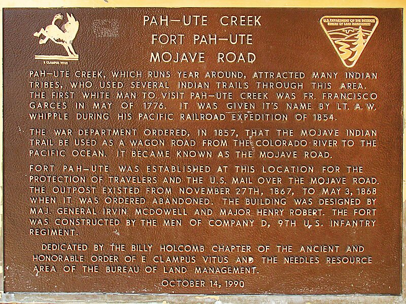
Mojave Road
The Mojave Road, also known as Old Government Road, is a historic route and present day dirt road across what is now the Mojave National… Read more…


Add Mojave Road to Your Trip
Create a detailed travel itinerary with smart routing, time estimates, and everything you need for a perfect trip.


The Mojave Road, also known as Old Government Road, is a historic route and present day dirt road across what is now the Mojave National Preserve in the Mojave Desert in the United States. This rough road stretched 147 miles from Beale's Crossing, to Fork of the Road location along the north bank of the Mojave River where the old Mojave Road split off from the route of the Old Spanish Trail/Mormon Road.
A four-wheel drive vehicle is required for all but a few short stretches of this road, which is unmaintained. The old road from Fork of the Road eastward along the Mojave River is interrupted after 10.9 acres by private property, below the site of the old Camp Cady. The road is resumed at an access point from the north in Manix Wash. Under optimal conditions, its full length of 133 miles from Beale's Crossing to Manix Wash can be travelled in 2 to 3 days.
Source: Wikipedia
More Information and Contact
Add Mojave Road to Your Trip
Create a detailed travel itinerary with smart routing, time estimates, and everything you need for a perfect trip.