
Mae West Peaks
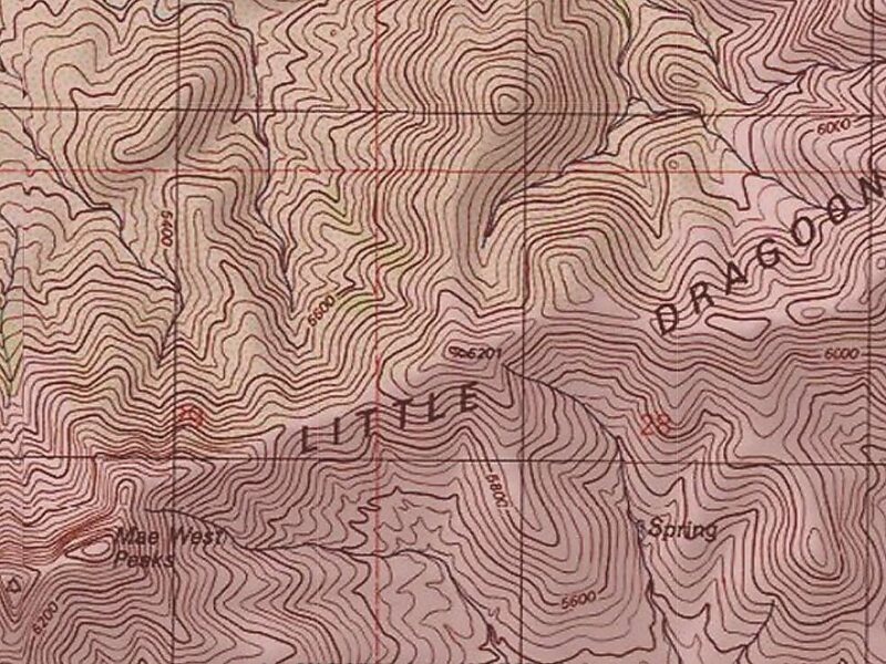
Mae West Peaks is a pair of summits in Cochise County, Arizona. The taller of the two was formerly known as Lime Peak and the elevation and… Leggi di più…


Mae West Peaks – Aggiungi Al Tuo Viaggio
Crea un itinerario di viaggio dettagliato con percorsi intelligenti, stime dei tempi e tutto ciò di cui hai bisogno per un viaggio perfetto.




Mae West Peaks is a pair of summits in Cochise County, Arizona. The taller of the two was formerly known as Lime Peak and the elevation and coordinates in the infobox refer to this peak. They are in the Little Dragoon Mountains, northwest of Texas Canyon and 3.3 miles west-southwest of the ghost town of Johnson, Arizona.
These summits were named for their shape, which were thought to be reminiscent of the figure of the actress Mae West. The name was collected by the United States Geological Survey between 1976 and 1980, and entered into the Geographic Names Information System on February 8, 1980.On the same date, name Lime Peak was assigned to a 6,655-foot peak, 1.8 miles to the northeast which is also in the Little Dragoon Mountains.
Source: Wikipedia
Ulteriori Informazioni E Contatti
Mae West Peaks – Aggiungi Al Tuo Viaggio
Crea un itinerario di viaggio dettagliato con percorsi intelligenti, stime dei tempi e tutto ciò di cui hai bisogno per un viaggio perfetto.