
Iztaccihuatl
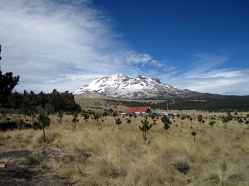
Iztaccíhuatl or Ixtaccíhuatl is a 5,230 m dormant volcanic mountain in Mexico located on the border between the State of Mexico and Puebla… 자세히 보기…


Iztaccihuatl – 여행에 추가
스마트 경로 안내, 소요 시간 예측 등 완벽한 여행에 필요한 모든 것을 포함한 상세한 여행 일정을 만드세요.




Iztaccíhuatl or Ixtaccíhuatl is a 5,230 m dormant volcanic mountain in Mexico located on the border between the State of Mexico and Puebla within Izta-Popo Zoquiapan National Park. It is the nation's third highest, after Pico de Orizaba at 5,636 m, and Popocatépetl at 5,426 m.
The name "Iztaccíhuatl" is Nahuatl for "White woman", reflecting the four individual snow-capped peaks which depict the head, chest, knees and feet of a sleeping female when seen from east or west. Iztaccíhuatl is to the north of its twin Popocatépetl, to which it is connected by the high altitude Paso de Cortés. Depending on atmospheric conditions Iztaccíhuatl is visible much of the year from Mexico City some 70 km to the northwest. The first recorded ascent was made in 1889, though archaeological evidence suggests the Mexica and previous cultures climbed it previously. It is the lowest peak containing permanent snow and glaciers in Mexico.
Source: Wikipedia
자세한 정보 및 문의
Iztaccihuatl – 여행에 추가
스마트 경로 안내, 소요 시간 예측 등 완벽한 여행에 필요한 모든 것을 포함한 상세한 여행 일정을 만드세요.