
Manila–Cavite Expressway
The Manila–Cavite Toll Expressway Project, signed as E3 of the Philippine expressway network and R-1 of Metro Manila's arterial road… 자세히 보기…


Manila–Cavite Expressway – 여행에 추가
스마트 경로 안내, 소요 시간 예측 등 완벽한 여행에 필요한 모든 것을 포함한 상세한 여행 일정을 만드세요.




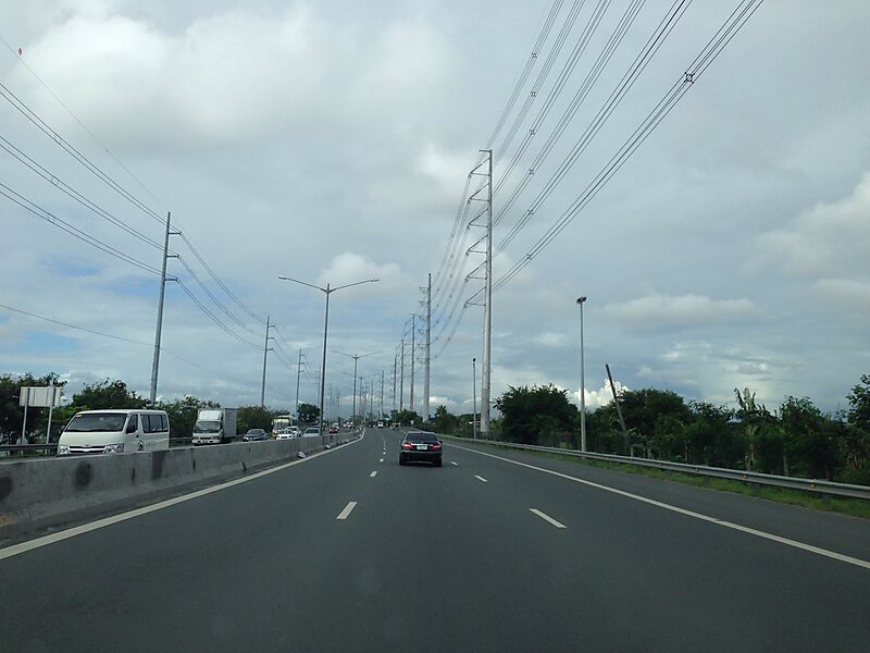
The Manila–Cavite Toll Expressway Project, signed as E3 of the Philippine expressway network and R-1 of Metro Manila's arterial road network, is a 14-kilometer-long controlled-access toll expressway linking Manila to the southern province of Cavite in the Philippines. At its north end, it feeds into and from Roxas Boulevard in the city of Parañaque in Metro Manila, also part of R-1. At the south end, it splits into two termini, both along the north coast in Kawit, Cavite. The first feeds into the intersection of Tirona Highway and Antero Soriano Highway. The second southern terminus is on the intersection of Tirona Highway and Antero Soriano Highway near the Aguinaldo Shrine.
The expressway also functions as a utility corridor carrying various high voltage power lines and water pipelines across the densely populated areas of Parañaque and Las Piñas. The final section of the Dasmariñas–Las Piñas Transmission Line and its substation was placed beside the highway.
Source: Wikipedia
자세한 정보 및 문의
Manila–Cavite Expressway – 여행에 추가
스마트 경로 안내, 소요 시간 예측 등 완벽한 여행에 필요한 모든 것을 포함한 상세한 여행 일정을 만드세요.