
Toutle River Sediment Retention Structure
The Sediment Retention Structure is an earthen dam, 1,888 feet long and 184 feet high, on the North Fork Toutle River in the U.S. state of… Lees meer…


Toutle River Sediment Retention Structure – Aan je reis toevoegen
Maak een gedetailleerde reisroute met slimme routing, tijdsinschattingen en alles wat je nodig hebt voor een perfecte reis.




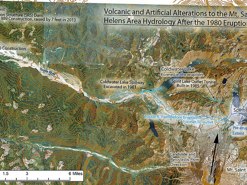
The Sediment Retention Structure is an earthen dam, 1,888 feet long and 184 feet high, on the North Fork Toutle River in the U.S. state of Washington. Completed by the United States Army Corps of Engineers in 1989, it is meant to prevent sediment from the 1980 eruption of Mount St. Helens from increasing flood risks along the Toutle and Cowlitz rivers.The Corps initially expected the basin behind the dam to be filled by 2035 with 258 million cubic yards of sediment.
Source: Wikipedia
Meer informatie en contact
Toutle River Sediment Retention Structure – Aan je reis toevoegen
Maak een gedetailleerde reisroute met slimme routing, tijdsinschattingen en alles wat je nodig hebt voor een perfecte reis.