Emi Koussi is a high pyroclastic shield volcano that lies at the southeast end of the Tibesti Mountains in the central Sahara, in the northern Borkou Region of northern Chad. The highest mountain of the Sahara, the volcano is one of several in the Tibesti range, and reaches an elevation of 3,447 metres, rising 3 km above the surrounding sandstone plains. The volcano is 60–70 kilometres wide and has a volume of 2,500 cubic kilometres.
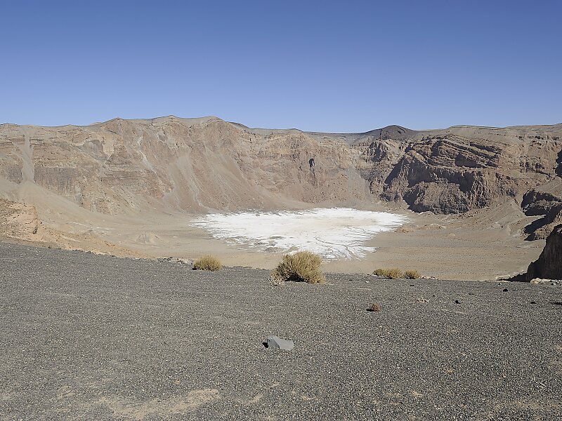
Two nested calderas cap the volcano, the outer one being about 15 by 11 kilometres in size. Within it on the southeast side is a smaller caldera known as Era Kohor, about 2 kilometres wide and 350 metres deep. Numerous lava domes, cinder cones, maars, and lava flows are found within the calderas and along the outer flanks of the shield.
Wikipedia https://en.wikipedia.org/wiki/Emi_Koussi
landingPages.LANDING_PAGE.DETAIL.ADDRESS Chad
landingPages.LANDING_PAGE.DETAIL.COORDINATES 19°49'57.497" N 18°33'39.224" E