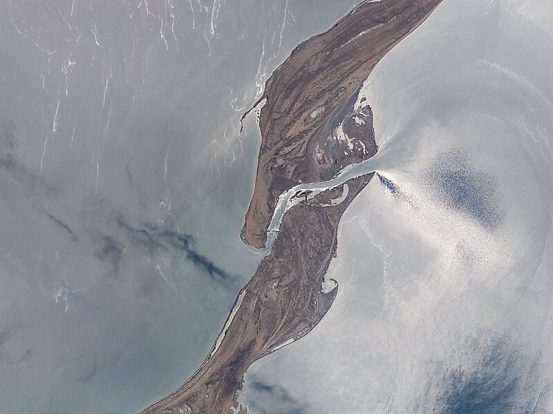
The Garabogazköl, or Garabogazköl Aylagy, is a shallow, water-filled, highly-saline depression in the northwestern corner of Turkmenistan. It forms a lagoon of the Caspian Sea and has a variable surface area, about 18,000 km2. The Caspian Sea proper sits immediately to the west, mostly divorced by a narrow, rocky ridge having a very narrow opening through which the Caspian waters flow, overwhelmingly, into it. There is likely to be a subterranean highly saline flow, only when there is less evaporation in winter, as in the case of the Turkish Straits year-round. The lagoon's volume fluctuates seasonally, accentuated by its salt evaporation ponds and natural counterpart surrounding, seasonally dry salt pans.
The city of Garabogaz lies on the ridge, about 50 km north of the channel between the main Caspian basin and the Garabogazköl lagoon. It has a population of about 10,000 people.
Wikipedia https://en.wikipedia.org/wiki/Garabogazköl
landingPages.LANDING_PAGE.DETAIL.ADDRESS Turkmenistan
landingPages.LANDING_PAGE.DETAIL.COORDINATES 41°20'1.384" N 53°38'46.455" E