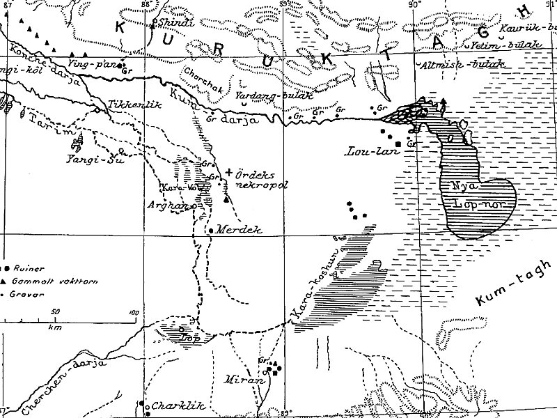
Lop Nur or Lop Nor is a now largely dried-up salt lake formerly located in the eastern fringe of the Tarim Basin in the southeastern portion of the Xinjiang Autonomous Region, northwestern China, between the Taklamakan and Kumtag deserts. Administratively, the lake is in Lop Nur town, also known as Luozhong of Ruoqiang County, which in its turn is part of the Bayingolin Mongol Autonomous Prefecture.
The lake system, into which the Tarim River and Shule River drain from the west and east respectively, is the last remnant of the historical post-glacial Tarim Lake, which once covered more than 10,000 km2 in the Tarim Basin but had progressively shrunk throughout the Holocene due to rain shadowing by the Tibetan Plateau. Lop Nur is hydrologically endorheic, it is landbound and has no outlet, and has relied largely on meltwater runoffs from the Tianshan, Kunlun and the western Qilian Mountains.
Wikipedia https://en.wikipedia.org/wiki/Lop_Nur
landingPages.LANDING_PAGE.DETAIL.ADDRESS China
landingPages.LANDING_PAGE.DETAIL.COORDINATES 40°42'29.571" N 90°55'28.524" E
