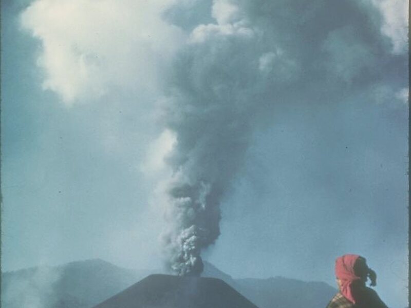
Parícutin is a cinder cone volcano located in the Mexican state of Michoacán, near the city of Uruapan and about 322 kilometers west of Mexico City. The volcano surged suddenly from the cornfield of local farmer Dionisio Pulido in 1943, attracting both popular and scientific attention.
Paricutín presented the first occasion for modern science to document the full life cycle of an eruption of this type. During the volcano's nine years of activity, scientists sketched and mapped it and took thousands of samples and photographs. By 1952, the eruption had left a 424-meter-high cone and significantly damaged an area of more than 233 square kilometers with the ejection of stone, volcanic ash and lava.
Wikipedia https://en.wikipedia.org/wiki/Parícutin
landingPages.LANDING_PAGE.DETAIL.ADDRESS Mexico
landingPages.LANDING_PAGE.DETAIL.COORDINATES 19°29'35.403" N -102°15'4.769" E
