The Braaid

landingPages.LANDING_PAGE.DETAIL.LOCAL_NAMEThe Braaid
landingPages.LANDING_PAGE.DETAIL.LOCATIONMiddle, Isle of Man

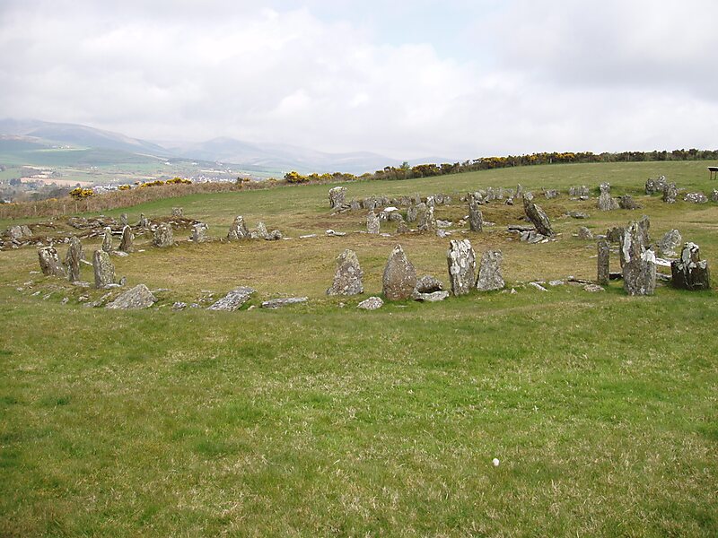
The Braaid is an Iron Age roundhouse and two Norse long houses on this site represent its occupation until the 11th or 12th century AD in the parish of Marown in the Isle of Man.

The site uniquely brings together buildings of Iron Age and Viking styles that were used together and survive down to the present.

The site lies between Braaid hamlet and Mount Murray at which reference an area map can be viewed.

landingPages.LANDING_PAGE.DETAIL.TAGS Arkeologisk funnstedHut Circle
landingPages.LANDING_PAGE.BUTTONS.DOWNLOAD landingPages.LANDING_PAGE.BUTTONS.DOWNLOAD landingPages.LANDING_PAGE.BUTTONS.SEE_MORE
 

landingPages.LANDING_PAGE.DETAIL.MORE_INFORMATION_AND_CONTACT

Wikipedia https://en.wikipedia.org/wiki/The_Braaid

landingPages.LANDING_PAGE.DETAIL.ADDRESS IM4 2, United Kingdom

landingPages.LANDING_PAGE.DETAIL.COORDINATES 54°9'26.557" N -4°33'59.347" E

landingPages.LANDING_PAGE.MOBILE_PANEL.HEADER

landingPages.LANDING_PAGE.MOBILE_PANEL.SUB_HEADER
landingPages.LANDING_PAGE.MOBILE_PANEL.FOOTER
landingPages.MOBILE.BANNER.TITLE landingPages.MOBILE.BANNER.DESCRIPTION
landingPages.MOBILE.BANNER.USE landingPages.MOBILE.BANNER.NOT_NOW