
Covered Bridge
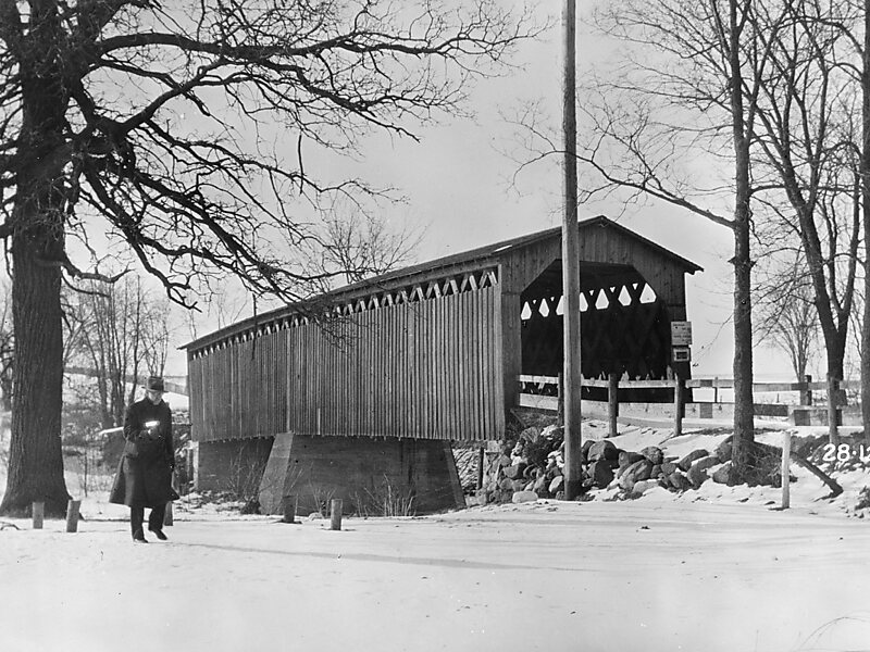
The Covered Bridge in Cedarburg, Ozaukee County, Wisconsin, United States, is one of the last remaining covered bridges in that state,… Czytaj więcej…


Covered Bridge – Dodaj Do Wycieczki
Stwórz szczegółowy plan podróży z inteligentnym wyznaczaniem tras, szacowanymi czasami i wszystkim, czego potrzebujesz na idealną wycieczkę.




The Covered Bridge in Cedarburg, Ozaukee County, Wisconsin, United States, is one of the last remaining covered bridges in that state, which once had about 40 covered bridges. Built in 1876 to cross Cedar Creek, the bridge is 120 feet long and is made of pine with oak lattices. It was listed on the National Register of Historic Places in 1973 and is now used only for pedestrian traffic.
Source: Wikipedia
Więcej informacji i kontakt
Covered Bridge – Dodaj Do Wycieczki
Stwórz szczegółowy plan podróży z inteligentnym wyznaczaniem tras, szacowanymi czasami i wszystkim, czego potrzebujesz na idealną wycieczkę.