



Mera Peak
Mera Peak is a mountain in the Mahalangur section, Barun sub-section of the Himalaya and administratively in Nepal's Sagarmatha Zone,… Ler mais…
Mera Peak – A planear uma viagem?
Cria o teu itinerário dia a dia na app Tripomatic.


Mera Peak is a mountain in the Mahalangur section, Barun sub-section of the Himalaya and administratively in Nepal's Sagarmatha Zone, Sankhuwasabha. At 6,476 metres it is classified as a trekking peak. It contains three main summits: Mera North, 6,476 metres; Mera Central, 6,461 metres; and Mera South, 6,065 metres, as well as a smaller "trekking summit", visible as a distinct summit from the south but not marked on most maps of the region.
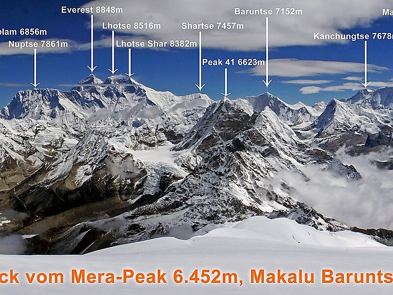
The height of Mera is often given as 6,654 metres, and claimed to be the highest trekking peak. This figure actually points to nearby Peak 41, which was mistakenly named Mera in a list of Himalayan peaks, and the figures were copied to the official trekking peak list as they were, including the wrong location coordinates.
Source: Wikipedia
Mais informações e contacto


Mera Peak – Adicionar à tua viagem
Cria um itinerário de viagem detalhado com rotas inteligentes, estimativas de tempo e tudo o que precisas para uma viagem perfeita.

