



The Thunderer
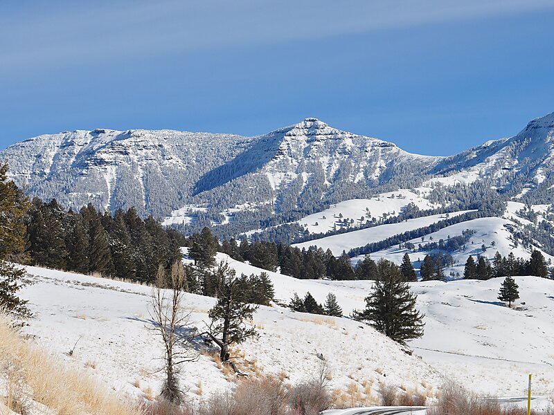
The Thunderer el. 10,558 feet is a mountain peak in the northeast section of Yellowstone National Park, in the Absaroka Range of the U.S.… Читать далее…


The Thunderer — добавь в свою поездку
Создай подробный маршрут с умным расчётом пути, оценкой времени и всем необходимым для идеальной поездки.




The Thunderer el. 10,558 feet is a mountain peak in the northeast section of Yellowstone National Park, in the Absaroka Range of the U.S. state of Wyoming. Named by members of the Arnold Hague Geological Survey of 1885 for its propensity to attract thunderstorms, the mountain is a long high ridge just north of Mount Norris. Prior to 1885, the peak was merely considered a high ridge extending north from Mount Norris rather than a separately named peak. The Thunderer is easily visible from the northeast entrance road as it passes up the Soda Butte Creek canyon.
The north end of the ridge can be reached via the 7.4 miles Thunderer Cutoff Trail. The trailhead is located just opposite the Pebble Creek Campground on the northeast entrance road. This trail passes through Chaw Pass to connect with the Cache Creek trail which parallels the southeast face of The Thunderer ridge.
Source: Wikipedia
Дополнительная информация и контакты
The Thunderer — добавь в свою поездку
Создай подробный маршрут с умным расчётом пути, оценкой времени и всем необходимым для идеальной поездки.