Schalkenmehrener Maar
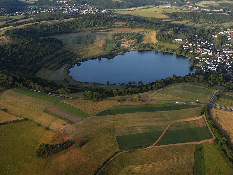
The Schalkenmehrener Maar is a maar roughly 3 kilometres southeast of the town of Daun in the Eifel in the German state of Rhineland… Read more…


Add Schalkenmehrener Maar to Your Trip
Create a detailed travel itinerary with smart routing, time estimates, and everything you need for a perfect trip.


The Schalkenmehrener Maar is a maar roughly 3 kilometres southeast of the town of Daun in the Eifel in the German state of Rhineland-Palatinate.
It is one of the Daun Maars or Daun Maar Group and is a double maar, comprising a western maar lake and an eastern dry maar. Both were formed around 10,500 years ago as the result of a phreatomagmatic explosion. The lake in the western part of the maar varies between 500 and 575 metres in diameter and is up to 21 metres deep. The height of the maar above sea level is 420 metres. It fills the more recent of the 2 maar basins. The eastern part of the maar is occupied by a raised bog.
Botanically, three different zones can be distinguished: the shore area, the raised bog and the slopes of the maar basin.
Source: Wikipedia
More Information and Contact
Add Schalkenmehrener Maar to Your Trip
Create a detailed travel itinerary with smart routing, time estimates, and everything you need for a perfect trip.