



Chaitén
Chaitén is a volcanic caldera 3 kilometres in diameter, 17 kilometres west of the elongated ice-capped Michinmahuida volcano and 10… Daha fazla oku…


Chaitén – Gezi mi Planlıyorsun?
Tripomatic uygulamasında gün gün güzergahını oluştur.


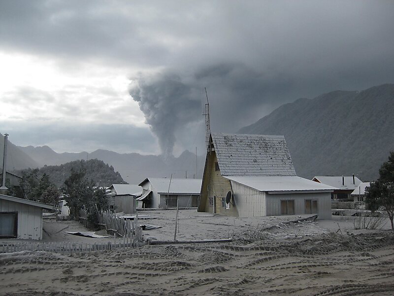
Chaitén is a volcanic caldera 3 kilometres in diameter, 17 kilometres west of the elongated ice-capped Michinmahuida volcano and 10 kilometres northeast of the town of Chaitén, near the Gulf of Corcovado in southern Chile. The most recent eruptive phase of the volcano erupted on 2008. Originally, radiocarbon dating of older tephra from the volcano suggested that its last previous eruption was in 7420 BC ± 75 years. However, recent studies have found that the volcano is more active than thought. According to the Global Volcanism Program, its last eruption was in 2011.
The caldera rim reaches 1,122 metres above sea level. Before the current eruption, it was mostly filled by a rhyolite obsidian lava dome that reached a height of 962 metres, partly devoid of vegetation. Two small lakes occupied the caldera floor on the west and north sides of the lava dome.
Source: Wikipedia
Daha Fazla Bilgi ve İletişim


Chaitén – Gezine Ekle
Akıllı rota oluşturma, tahmini süreler ve kusursuz bir gezi için ihtiyacın olan her şeyle ayrıntılı bir seyahat güzergahı oluştur.

