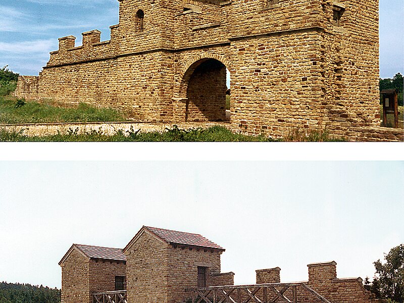
Tripomatic

Upper Germanic-Rhaetian Limes

The Upper Germanic-Rhaetian Limes, or ORL, is a 550-kilometre-long section of the former external frontier of the Roman Empire between the… Read more…

fortificationarchaeological site
Riverside Hotel
Taxi · 8 min
Upper Germanic-Rhaetian Limes
2h
Walk · 6 min
Corner Café
45 min
Walk · 18 min
Riverside Hotel

Add Upper Germanic-Rhaetian Limes to Your Trip

Create a detailed travel itinerary with smart routing, time estimates, and everything you need for a perfect trip.

3M+ downloads · 4.6 stars · 15 years of trip planning
QR code
Scan to download the app

The Upper Germanic-Rhaetian Limes, or ORL, is a 550-kilometre-long section of the former external frontier of the Roman Empire between the rivers Rhine and Danube. It runs from Rheinbrohl to Eining on the Danube. The Upper Germanic-Rhaetian Limes is an archaeological site and, since 2005, a UNESCO World Heritage Site. Together with the Lower Germanic Limes it forms part of the Limes Germanicus.

The Limes used either a natural boundary such as a river or typically an earth bank and ditch with a wooden palisade and watchtowers at intervals. A system of linked forts was built behind the Limes.

Source: Wikipedia

More Information and Contact

Address 56337, Germany
Coordinates 50°23'44.072" N, 7°43'37.296" E
Riverside Hotel
Taxi · 8 min
Upper Germanic-Rhaetian Limes
2h
Walk · 6 min
Corner Café
45 min
Walk · 18 min
Riverside Hotel

Add Upper Germanic-Rhaetian Limes to Your Trip

Create a detailed travel itinerary with smart routing, time estimates, and everything you need for a perfect trip.

3M+ downloads · 4.6 stars · 15 years of trip planning
QR code
Scan to download the app

More interesting places