马特诺玛瀑布
Columbia River Gorge National Scenic Area, 🇺🇸 美国
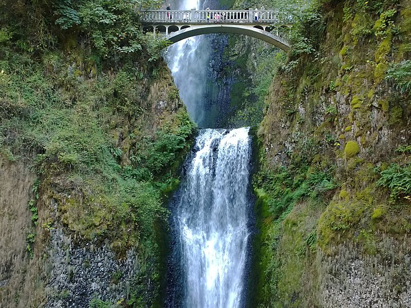
马特诺玛瀑布 是位于哥伦比亚河峡谷南岸 的一个瀑布。瀑布主要分为两段,其中一段在542英尺 处,紧接着的一段在69英尺 处,两段瀑布中间有一段9英尺 的斜坡,因此一般认为整个瀑布的落差为620英尺… 了解更多…
waterfall

Riverside Hotel

马特诺玛瀑布
2h

Corner Café
45 min
Riverside Hotel


马特诺玛瀑布 是位于哥伦比亚河峡谷南岸 的一个瀑布。瀑布主要分为两段,其中一段在542英尺 处,紧接着的一段在69英尺 处,两段瀑布中间有一段9英尺 的斜坡,因此一般认为整个瀑布的落差为620英尺 。马特诺玛瀑布是俄勒冈州落差最大的瀑布。瀑布附近有一个标志,上面标记着该瀑布是美国第二高的全年性瀑布,不过有瀑布方面的专家反对这一说法。
Source: Wikipedia
更多信息与联系方式
Wikipedia en.wikipedia.org/wiki/Multnomah_Falls
地址 (Unnamed Road), 97019, United States
坐标 45°34'33.429" N, 122°6'54.672" W
Riverside Hotel
马特诺玛瀑布
2h
Corner Café
45 min
Riverside Hotel