
Mercer's Mill Covered Bridge
The Mercer's Mill Covered Bridge or Mercer's Ford Covered Bridge is a covered bridge that spans the East branch of the Octoraro Creek on… 了解更多…


Mercer's Mill Covered Bridge – 添加到你的旅行
创建详细的旅行行程,包含智能路线、时间预估,以及你打造完美旅行所需的一切。




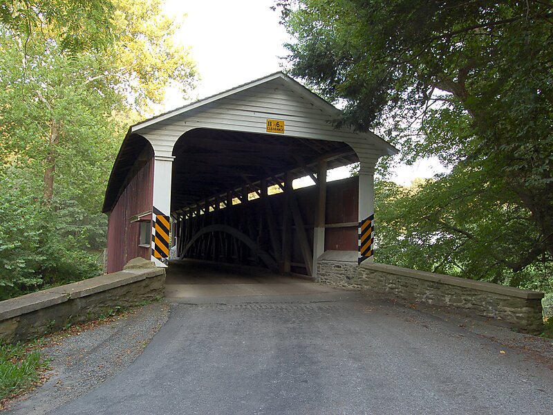
The Mercer's Mill Covered Bridge or Mercer's Ford Covered Bridge is a covered bridge that spans the East branch of the Octoraro Creek on the border between Lancaster County and Chester County in Pennsylvania, United States. A Lancaster County-owned and maintained bridge, its official designation is the East Octoraro #2 Bridge.The bridge has a single span, wooden, double Burr arch trusses design with the addition of steel hanger rods. The deck is made from oak planks. It is painted red, the traditional color of Lancaster County covered bridges, on both the inside and outside. Both approaches to the bridge are painted in the traditional white color. The bridge has a single window on only one side of the bridge.
The bridge's WGCB Numbers are 38-15-19/38-36-38. Added in 1980, it is listed on the National Register of Historic Places as structure number 80003509. It is located at 39°55′53.4″N 75°58′53.4″W.
Source: Wikipedia
更多信息与联系方式
Mercer's Mill Covered Bridge – 添加到你的旅行
创建详细的旅行行程,包含智能路线、时间预估,以及你打造完美旅行所需的一切。