


Okres Mù Cang Chải
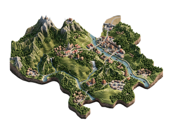
Mù Cang Chải is a mountain district in Yên Bái province in northern Vietnam. It is known for its rice terraces, which cover steep hillsides and are among the most photographed in Southeast Asia. The terraces of La Pán Tẩn, Chế Cu Nha and Để Xu Phình are national heritage sites. The district is home to the Hmong people.
Most visitors come for the harvest in September and October. Two nights is enough to see the main viewpoints.

Okres Mù Cang Chải – Plánuješ výlet?
Sestav si itinerář den po dni v aplikaci Tripomatic.


Kdy navštívit
Mid-September to mid-October is the best time, when the terraces are golden and the harvest is on. Late May to June is the water season, when fields are flooded and reflect the sky. The winter from November to February is cold and foggy, and the fields are bare. July and August bring heavy rain and landslides.
Nejlepší doba k návštěvě: únor, březen, listopad
Hlavní památky
- Parachute site is the take-off site for paragliding, with a wide view over the terraced valley. Flights run in September and October.
- Bamboo forest is a quiet bamboo forest on the hillside.
- Thôn Lả Khắt is a Hmong village with traditional houses and fields.
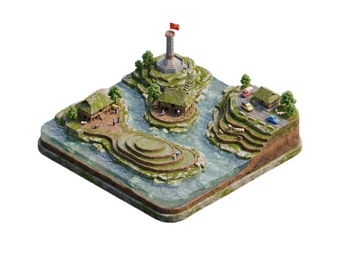
- Mu Cang Chai Monument is a monument in the district town.
The best terraces are La Pán Tẩn, Chế Cu Nha and Để Xu Phình, along Highway 32. Khau Phạ Pass, on the road from the south, is a famous mountain pass with long views.
Doporučené výběry
Co zažít
- Photograph the terraces: Go early or late for the best light.
- Paraglide over the valley: Flights run in the harvest season.
- Stay in a Hmong homestay: Simple rooms in a village.
- Walk through the fields: Short trails link villages and terraces.
- Try local food: Sticky rice and grilled stream fish are common.
Prohlídky a aktivity
Okres Mù Cang Chải – Mapa

Jednodenní výlety
Kam vyrazit na průzkum
Jak se tam dostat
- By bus: Sleeper buses and minivans run from Hanoi to Mù Cang Chải in about 6 to 8 hours, often via Nghĩa Lộ.
- By car: A private car with a driver is comfortable and flexible.
- By train: Trains run to Yên Bái and Lào Cai. Then continue by road. Vietnam Railways
- By air: There is no airport in the district. Hanoi is the nearest hub.
Doprava na místě
- Motorbike: The most popular way, but roads are steep and can be wet. Hire with a driver if you are not experienced.
- Car with driver: Best for the terraces and Khau Phạ Pass.
- Walking: Short walks around the terraces and villages are easy and pleasant.
Řízení auta
- Is a car worth it? A car with a driver is the best way to see the terraces. Roads are narrow and winding.
- Roads: Highway 32 and Khau Phạ Pass are steep. Fog and landslides are common in summer.
- Fuel: Fill up in Nghĩa Lộ or Mù Cang Chải town.
Jídlo a pití
Hmong food in the district is simple and hearty. Try xôi, sticky rice from Tú Lệ, grilled pork and chicken, and fresh stream fish. Rice wine and corn wine are common. Meals are usually eaten at homestays and small family restaurants in the town.
Bezpečnost a zdraví
Mù Cang Chải is a quiet and safe district.
- Mountain roads are steep and can be slippery. Landslides are possible in summer.
- Wear a helmet if you ride a motorbike. Avoid night riding.
- Nights are cold in winter. Bring warm clothes.
- Ask before taking photos of people, and do not walk on the terrace edges.
- Medical care is basic. Carry your own medicines.
Historie
The Hmong have lived in the mountains of Mù Cang Chải for generations and built the terraces by hand over many years. The district is remote and remained isolated until roads improved in the 20th century.
Three terrace areas were listed as national heritage sites in 2007. Since then tourism has grown, and the harvest festival and paragliding season now attract visitors from Vietnam and abroad.
Fakta o zemi
Quick practical facts for Vietnam at a glance:
- Měna
- vietnamský dong VND ₫ · Platby kartou · Běžně přijímány
- Elektřina
- 220 V · 50 HzTyp A / Typ C / Typ F
- Jazyky
- vietnamština
- Voda z kohoutku
- Není pitná
- Strana jízdy
- Vpravo
- Předvolba
- +84
Okres Mù Cang Chải – Naplánuj si jednotlivé dny
Proměň místa z tohoto průvodce ve skutečný itinerář s chytrým plánováním tras, časovými odhady a vším, co potřebuješ pro bezstarostný výlet.


Související destinace

Data: © OpenStreetMap contributors, Wikidata, Wikipedia, Tripomatic, Official websites, geoBoundaries (CC BY 4.0). Tours by GetYourGuide. We earn commission from bookings. Travel guide generated with AI.