



Tatra
The Tatra Mountains are the highest range in the Carpathians, straddling the border between Slovakia and Poland. Sharp granite peaks, glacial lakes, and deep pine forests give them a scale that feels closer to the Alps than to most of Central Europe. The Slovak side, the High Tatras, holds the tallest summits and the busiest resort towns; the Polish side, centered on Zakopane, has its own long tradition of mountain tourism.
This is a destination for hikers, climbers, and anyone who wants dramatic scenery within a few hours of Vienna, Kraków, or Bratislava. Summer brings marked trails to alpine lakes and mountain huts, while winter turns the resort towns into ski bases. It suits an active trip more than a relaxed city break — most visitors come to walk, climb, or ski, not to sightsee from a café table.

Tatra – Planst du eine Reise?
Erstelle deine Reiseroute Tag für Tag in der Tripomatic-App.


Beste Reisezeit
Summer (June to September) is the main hiking season, with long days and the best chance of clear peaks. Spring and autumn are quieter and cooler, with unpredictable weather higher up. Winter turns the valley towns into ski resorts, but most high mountain trails close for the season.
The best window for serious hiking is mid-June to the end of October, once the winter trail closures lift. Snow can linger on the highest passes into June, and afternoon thunderstorms are common in July and August, so plan to be off exposed ridges by early afternoon.
Top-Sehenswürdigkeiten
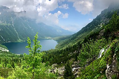
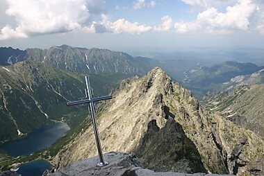
Morskie Oko is the best-known lake in the whole range, a turquoise tarn just across the border on the Polish side, ringed by cliffs. It's a popular, fairly easy walk from the nearest car park, so it draws crowds in summer.
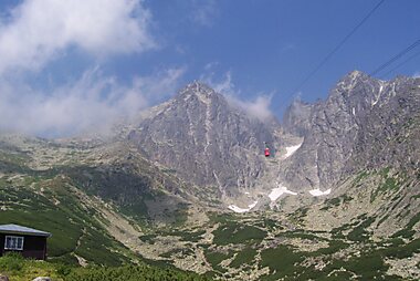
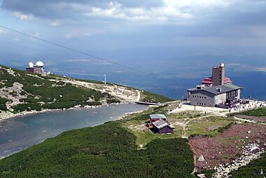
Lomnický štít is the second-highest peak in the Tatras, and the only major summit reachable by cable car from Tatranská Lomnica. The observation deck gives a wide view over both the Slovak and Polish sides without a hard climb.
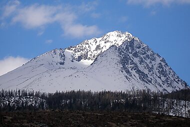
Gerlachovský štít is the highest point in the entire Carpathian range. Reaching the summit legally requires a certified mountain guide, but the approach trail still makes for a serious, rewarding day out.
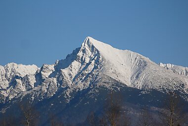
Kriváň has a distinctive triangular silhouette that made it a symbol of Slovak national identity, and it's traditionally climbed on 29 August to mark the anniversary of the Slovak National Uprising.
Rysy is the highest peak that can be climbed without a guide, and one of the most popular multi-day targets in the range. The final scramble is steep enough to feel earned.
Skalnaté pleso sits at the upper cable-car station below Lomnický štít, with a small glacial lake and sweeping views back down toward Tatranská Lomnica.
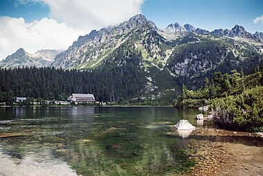
Popradské pleso is a classic, gentler hike from Štrbské Pleso, with a mountain hut on its shore that makes a good turnaround point or overnight stop.
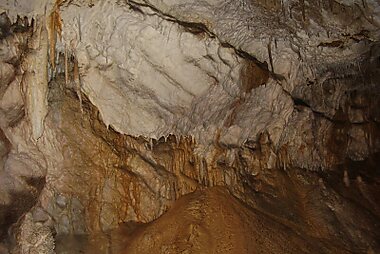
Belianska jaskyňa is the only show cave open to visitors in the Tatras, with guided tours through chambers of stalactites and underground pools — a good option on a rainy day when the high trails aren't an option.
Empfohlene Listen

Tatra Mountains Unmissables
The High Tatras, spanning the border of Poland and Slovakia, are characterized by dramatic granite peaks and deep glacial valleys. This selection features iconic summits like Kriváň and Lomnický štít, alongside Morskie Oko, the largest lake in the range. It includes the 70-meter Siklawa waterfall and Belianska Cave, the only accessible cave in the Slovak Tatras. The list also covers historic alpine shelters, such as Rainerova Hut, built in 1863, which serve as key waypoints for high-altitude hikers.
17 Orte
Editor's Choice: High Tatras
The High Tatras feature a diverse range of alpine landscapes, from Gerlachovský štít, the highest peak in the Carpathian Mountains, to Veľké Hincovo pleso, the range's largest and deepest glacial lake. This selection covers accessible summits like Slavkovský štít and Rysy, alongside the Belianska Cave, the only cave in the region open to the public. Hikers can find refuge in historic alpine huts such as Téryho and Zamkovského, or explore the cascades of the Cold Stream and the Great Waterfall near Starý Smokovec.
17 Orte


Iconic Alpine Huts and Shelters
Spanning the High and Western Tatras across the Slovak-Polish border, these alpine huts provide essential refuge and dining for hikers. The selection includes historic stone structures like the 19th-century Rainerova Hut and high-altitude shelters such as Chata pod Rysmi, situated at 2,250 meters. Many of these sites, located near glacial lakes like Morskie Oko and Green Mountain Lake, are supplied exclusively by mountain porters and serve as vital hubs for major trails including the Tatranská Magistrála.
20 Orte


Erlebnisse & Aktivitäten
- Ride the historic cog railway between Poprad and the resort villages, a scenic trip in its own right rather than just a way to get around.
- Spend a night in a mountain hut partway up a trail, sharing a simple dinner with other hikers before an early start the next morning.
- Join the traditional climb of Kriváň on 29 August, when hundreds of Slovaks hike to the summit to mark the Slovak National Uprising.
- In winter, ski or snowboard one of the resort areas below the peaks, then warm up with mulled wine at a slopeside chalet.
- Swim or paddle-board on Popradské pleso in summer, with the high peaks reflected in the water.
Touren & Aktivitäten
Tatra — Karte

 Interaktive Karte öffnen
 Tagesausflüge
For a break from the mountains, or a rainy-day backup, several worthwhile towns and sights sit within an hour or two of the resort villages.
- Kežmarok — about 20–30 minutes from Tatranská Lomnica or Poprad. A small historic town with a UNESCO-listed wooden Lutheran church, built without a single metal nail.
- Levoča — roughly 45 minutes away. A walled medieval town on the UNESCO list, with a soaring town-hall square and the world's tallest carved wooden altar inside its main church.
- Spiš Castle — around an hour from Poprad, near Levoča. One of the largest castle complexes in Central Europe, its ruins visible for miles across the surrounding hills.
- Liptovský Mikuláš — about an hour west, and the gateway to the Demänovská Valley's show caves and the Jasná ski area on the far side of the Low Tatras.
- Zakopane — 1.5–2 hours by road across the Polish border, for a taste of Tatra life on the other side of the range, with its own wooden architecture and mountain markets.
Orte zum Entdecken
In the High Tatras: the main resort villages sit at the foot of the peaks, each with its own character. Starý Smokovec is the oldest and most central resort, with the cog railway station. Štrbské Pleso is built around its own glacial lake and is the main base for Rysy and the western peaks. Tatranská Lomnica is the base for the Lomnický štít cable car. All three sit within Vysoké Tatry, the wider municipality covering the mountain resorts.
Gateway city: Poprad in the valley below is the main transport hub, with the regional airport and the mainline rail and bus connections most visitors arrive through.
Across the border: Zakopane is the main Polish resort town on the other side of the range, with easier access from Kraków.
More Slovak mountains: Malá Fatra, west of the Tatras, offers similar hiking with far fewer crowds.
Anreise
- By air: Poprad–Tatry Airport has limited scheduled service (seasonal routes to a handful of European cities) and is the closest option, about 10 km from Poprad. Most travelers fly into Košice or Bratislava in Slovakia, or Kraków in Poland, and continue by train, bus, or car — Kraków is around 1.5–2 hours by road from the Polish side (Zakopane), and Bratislava is roughly 4–5 hours by train from the Slovak side.
- By train: Poprad has the main railway station, on the line connecting Bratislava, Žilina, and Košice. From there, the narrow-gauge Tatra Electric Railway runs up into the mountains to Starý Smokovec, Štrbské Pleso, and Tatranská Lomnica.
- By bus: long-distance coaches connect Poprad with Bratislava, Košice, and other major Slovak cities; regional buses also cross the border to Zakopane and Kraków.
Unterwegs vor Ort
- Public transit: the Tatra Electric Railway (TEŽ) links Poprad with Starý Smokovec, Štrbská Pleso, and Tatranská Lomnica, and a local bus network fills in the gaps between resort villages. Tickets can be bought at station counters or vending machines; buy before boarding rather than expecting to pay on board. Timetables and tickets: ZSSK (Slovak Rail).
- Cable cars and funiculars: several lifts carry hikers up from the resort villages toward the high trails — useful both for reaching a trailhead faster and for a scenic ride on their own.
- Taxi / ride-hailing: taxis are available in the main resort towns; ride-hailing apps have limited coverage in the mountains, so arrange a taxi by phone or through your accommodation if needed.
Autofahren
- Is a car worth it?: useful for exploring the wider region at your own pace, but not necessary if you're staying in one resort village and hiking from there — the cog railway and local buses cover the main routes well.
- Parking: each resort village has paid car parks near the train station and main lifts; they fill early on summer and winter weekends, so arrive before mid-morning.
- Mountain roads: some higher roads and passes close in winter or after heavy snow — check conditions before setting out between November and April.
- Vignette: Slovak motorways and expressways require an electronic vignette, purchased online or at border crossings and petrol stations.
Essen & Trinken
After a day on the trails, mountain huts and village restaurants lean hearty: thick soups, dumplings, and smoked meats built to refuel a hiker. Sheep's-milk cheese from the surrounding highland pastures shows up everywhere, from the national dish of potato dumplings to simple fried slices served with cranberry sauce.
For something distinctive, stop at a mountain hut along a hiking trail rather than a restaurant in the valley — most serve simple, filling food and a bowl of hot soup that tastes better for the walk it took to get there. In the resort villages, look for restaurants built around a wood-fired stove or open fireplace, a style particular to the region.
Sicherheit & Gesundheit
The Tatras are generally safe — petty crime against tourists is rare, and the main risks come from the mountains themselves rather than from other people.
- Stay on marked trails. Hiking off the marked trail network inside Tatra National Park (TANAP) is not allowed without a certified guide, both for safety and to protect the park's wildlife.
- Check the seasonal closures. Most high-mountain trails close each year from 1 November to 31 May for avalanche safety and to protect wildlife during the winter and spring. Trails to the mountain huts stay open year-round; the main hiking season runs from mid-June to the end of October.
- Weather turns fast. Afternoon thunderstorms are common in summer, and temperatures drop quickly with altitude. Check the forecast before setting out, start early, and plan to be off exposed ridges and summits by early afternoon.
- Mountain rescue. If you or someone else needs help in the mountains, call the Mountain Rescue Service (Horská záchranná služba) on 18 300, or the general European emergency number 112. Rescue costs in Slovakia are not automatically covered, so travel insurance with mountain rescue coverage is strongly recommended before you hike.
- Tap water is safe to drink throughout the region.
Geschichte
Organized mountain tourism in the Tatras began in the 19th century, when the resort villages that still anchor the region today — Starý Smokovec among the first — grew up around spa hotels catering to visitors from across the Austro-Hungarian Empire. The Tatra Electric Railway, opened in the early 20th century, made the high valleys accessible without a long climb and cemented the area's popularity.
The mountains have also carried symbolic weight for Slovaks well beyond tourism. Kriváň's sharp profile made it an emblem of Slovak identity, appearing on currency and in national songs. On the border high above Rysy, Poland and Slovakia meet at one of the most recognizable frontiers in Central Europe, a reminder that these mountains have divided and connected two nations for centuries.
Länderfakten
Quick practical facts for Slovakia at a glance:
- Währung
- Euro EUR € · Kartenzahlung · Häufig akzeptiert
- Notrufnummern
- 112
- Stromnetz
- 230 V · 50 HzSteckertyp C / Steckertyp E
- Sprachen
- Slowakisch
- Leitungswasser
- Trinkbar
- Fahrseite
- Rechtsverkehr
- Telefonvorwahl
- +421


Tatra – Plane deine Tage
Verwandle die Orte aus diesem Reiseführer in eine echte Reiseroute mit intelligenter Routenführung, Zeitschätzungen und allem für eine perfekte Reise.




