


Εθνικό Πάρκο Τρίγκλαβ
Triglav National Park covers almost all of the Slovenian part of the Julian Alps, in the country's north-west. It is the country's only national park and protects about 4% of its land. Limestone peaks, glacial lakes, deep gorges and the bright green Soča River are all within a day's reach of each other.
The park suits very different trips. You can spend a gentle week of lakeside walks, waterfalls and alpine pastures from a base in a valley village. You can also tackle multi-day hut-to-hut treks or the climb to the summit of Triglav, the national symbol that appears on Slovenia's coat of arms and flag. There is no single entrance or gate: villages around the edge act as the gateways, and the main visitor areas are Bohinj in the south-east, the Upper Sava Valley in the north and the Soča Valley in the west.

Εθνικό Πάρκο Τρίγκλαβ – Σχεδιάζεις ταξίδι;
Φτιάξε το δρομολόγιό σου ημέρα με την ημέρα στην εφαρμογή Tripomatic.


Πότε να πας
Late June to September is the main season. Mountain huts are open, high trails are mostly free of snow, and buses run to the trailheads. July and August are warm in the valleys but bring crowds and frequent afternoon thunderstorms in the mountains. September is often the best month: stable weather, fewer people and the first autumn colours. In winter the high peaks are for experienced mountaineers only, while the Vogel ski area above Lake Bohinj and the frozen waterfalls attract winter visitors.
The biggest local event is the Cows' Ball in Bohinj, held on a Sunday in mid-September. Herders bring their cattle down from the summer pastures, decorated with flowers, and the day continues with folk music, local cheese and food stalls.
Κορυφαία αξιοθέατα




Triglav is Slovenia's highest mountain and the heart of the park. Most climbers take two days, with a night in a mountain hut. The final sections are exposed and secured with steel cables, so most first-time visitors admire it from the valleys or hire a mountain guide.
Lake Bohinj is the largest permanent lake in Slovenia, framed by steep mountain walls. A path circles the lake in three to four hours, and in summer you can swim, kayak or rent a stand-up paddleboard.
Savica Waterfall drops about 78 m into a narrow rock basin above the western end of Lake Bohinj. A stepped path leads to the viewpoint in 15–20 minutes, and there is an entrance fee.
Triglav Lakes Valley holds a chain of glacial lakes between bare limestone peaks. It is the most popular high-mountain hike in the park, usually done over two days with a night in a mountain hut.
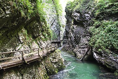
Vintgar Gorge is a 1.6 km gorge on the eastern edge of the park, a short ride from Bled. Wooden walkways run above the clear green Radovna river. The route is one-way, it closes in winter, and in summer it is wise to book a time slot online.
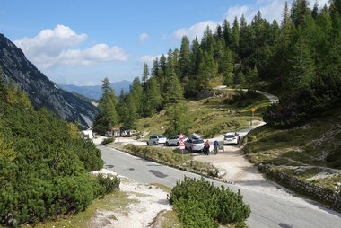
Vršič Pass is the highest road pass in Slovenia at 1,611 m. Its 50 hairpin bends link Kranjska Gora with the Trenta valley, and the views from the top and from the nearby huts are among the best you can reach by road.
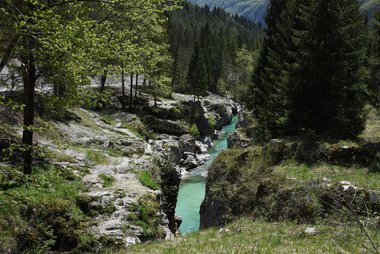
Great Soča Gorge is a 750 m stretch where the Soča has cut a gorge up to 15 m deep, with emerald pools at the lower end. A hanging footbridge and a short forest path give the best views.
Tolmin Gorges is the park's lowest point, at about 180 m near Tolmin. Short but steep paths lead past turquoise pools and under rock walls up to 60 m high to the Bear's Head, a huge boulder wedged between the walls.
Προτεινόμενες λίστες


Historical and Religious Sites
Triglav National Park preserves a complex history, particularly the legacy of the World War I Isonzo Front. This collection features strategic Austro-Hungarian fortifications like Kluže and Fort Hermann, alongside poignant memorials such as the Russian Chapel and the Javorca Memorial Church. The list also includes traditional high-altitude chapels and Gothic parish churches with centuries-old frescoes, reflecting the region's spiritual heritage and its role as a significant historical crossroads between Central Europe and the Mediterranean.
19 μέρη
Slovenia's Natural Wonders
Triglav National Park encompasses the jagged limestone peaks and emerald waters of the Julian Alps. This collection highlights the park's diverse geology, from the carved depths of Vintgar and Mostnica Gorges to the high-altitude Mangart Saddle and the Triglav Lakes Valley. It includes natural monuments like the Heathen Maiden rock face, the 78-meter Savica Waterfall, and numerous alpine peaks offering panoramic views over glacial valleys and Lake Bohinj.
49 μέρηΤι να ζήσεις
Many of the best moments here are things you do rather than places you look at.
- Raft or kayak the Soča: the river around Bovec is famous for rafting, kayaking and canyoning in clear, cold, emerald water. Local operators run half-day trips from late spring to autumn.
- Drive the Mangart road: Slovenia's highest road climbs from Log pod Mangartom to Mangart Saddle at about 2,000 m. Go early on a clear morning for views over the Julian Alps into Italy. Cars pay an environmental fee, numbers are capped at busy times, and the road is closed in winter.
- Walk behind a waterfall: at Peričnik Falls in the Vrata valley, a path leads behind the 52 m lower fall.
- Follow the Soča Trail: a riverside path runs from the source of the Soča down the Trenta valley towards Bovec, past suspension bridges, the Alpine Botanical Garden Juliana and the Great Soča Gorge. The whole trail takes about 7–8 hours, but any short section works well.
- Ride the Vogel cable car: it lifts you from the shore of Lake Bohinj to about 1,500 m in a few minutes. In summer it is a start point for ridge walks, and in winter it serves a small ski area.
- Spend a night in a mountain hut: simple huts serve hot meals and beds along all the main trails. Book ahead in July and August and bring a sleeping liner.
Περιηγήσεις και δραστηριότητες
Εθνικό Πάρκο Τρίγκλαβ — Χάρτης

Ημερήσιες εκδρομές
The towns around the park are worth a day of their own. These are ordered roughly from closest to farthest from the main valley bases.
- Bled (≈30–40 min by car or bus from Bohinj): the lake with its island church and the castle on a cliff above it make Slovenia's best-known view.
- Radovljica (≈15 min by car from Bled): a small, well-kept old town on a terrace above the Sava, with a beekeeping museum and gingerbread traditions.
- Kobarid (≈25 min by car from Bovec): its museum tells the story of the First World War front on the Soča, and the Kozjak waterfall is a short drive and walk from town.
- Kranjska Gora and Planica (≈1 h 15 min by car from Bovec over the Vršič Pass, which closes in winter): a mountain resort with Lake Jasna, and the nearby Planica valley with its giant ski-jumping hills.
- Ljubljana (≈45 min by car from Bled, ≈1 h 20 min by bus): the capital's riverside old town makes an easy city break between mountain days.
Μέρη για εξερεύνηση
The park has only small villages inside it. Visitors stay in the villages and small towns around its edge, each the gateway to a different side of the mountains.
South-east: lakes and pastures
- Bohinj sits right at Lake Bohinj and is the best base for the lake, Savica Waterfall, the Vogel cable car and the hike to the Triglav Lakes Valley.
- Bled has the widest choice of hotels and the best bus links, with the Vintgar and Pokljuka gorges close by.
- Radovljica is a quieter, cheaper alternative near Bled with a railway station.
North: the Upper Sava Valley
- Kranjska Gora is the base for the Vršič Pass, Planica and the Vrata and Martuljek valleys below the north face of Triglav.
West: the Soča Valley
Πώς να πας
- By air: Ljubljana Jože Pučnik Airport is the nearest airport with scheduled flights. It is about 30 minutes by car from Bled and about 1 hour from Bohinj. For the Soča Valley side, Trieste and Venice airports in Italy are also practical with a hire car.
- By train: trains from Ljubljana run to Lesce-Bled station on the line towards Jesenice and Austria. The scenic Bohinj railway calls at Bled Jezero and Bohinjska Bistrica, then continues through the mountains to Most na Soči near Tolmin. Slovenian Railways
- Car train: a car-carrying train runs a few times a day between Bohinjska Bistrica and Most na Soči, a shortcut between the Bohinj and Soča sides. The fastest departure takes about 45 minutes; check the timetable, as other runs take longer. Tickets are sold on board and places are first come, first served.
- By bus: buses from Ljubljana bus station run about hourly to Bled (≈1 h 20 min) and on to Lake Bohinj (≈2 h in total). Kranjska Gora and the Soča Valley towns also have bus connections from Ljubljana.
Μετακινήσεις
- Seasonal buses: in summer, extra buses link the Bohinj villages with the Savica Waterfall, the Vogel cable car and Ukanc. Parking near these sights is limited and paid, so the bus is often easier. Bohinj traffic and buses
- Over the Vršič Pass: in summer a bus crosses the pass between Kranjska Gora and Bovec, stopping at trailheads in the Trenta valley. Check the current timetable before you go. Soča Valley public transport
- Regional buses: other routes, such as Bled–Bohinj and Kranjska Gora–Mojstrana, run all year. Buy tickets from the driver.
- On foot: the park is made for walking. Trails are well marked with a red-and-white circle, and huts sit a few hours apart on the main routes.
- Cycling: bikes are allowed only on roads and designated cycling routes. The flat valley roads around Bohinj and the Soča Trail area suit e-bikes well.
Οδήγηση
- Is a car worth it?: yes, if you want to move between the Bohinj, Upper Sava and Soča sides, which are far apart by road. A car is less useful within Bohinj in summer, where buses avoid the parking problem.
- Parking: car parks at popular trailheads and sights are paid and fill early in July and August, especially at Lake Bohinj, the Savica Waterfall, Vintgar and the Vrata valley. Overnight parking outside marked areas is not allowed.
- Mountain roads: the Vršič Pass and the Mangart road close in winter, and cars pay an environmental fee on the Mangart road. Expect narrow roads, cyclists and slow traffic on hairpins.
- Car train: the Bohinj car train saves the long drive around the mountains between Bohinj and the Soča Valley.
Φαγητό & ποτό
Mountain food here is simple and filling. Look for Tolminc and Bovec cheese and the strong, creamy mohant from Bohinj. The Soča's marble trout is the local fish. In mountain huts, expect jota (a bean and sauerkraut stew), ričet (barley stew), štruklji (rolled dumplings) and žganci (buckwheat or corn spoonbread) with sour milk. The Alpine Dairy Museum in Stara Fužina shows how herders made cheese on the summer pastures, and some pastures above Bohinj still sell their own cheese in summer.
For eating out, the best clusters are the villages around Lake Bohinj, the centre of Bovec and the restaurants in and around Kobarid. Kobarid's area is also home to Hiša Franko, a restaurant with three Michelin stars run by chef Ana Roš; book weeks or months ahead. Carry some cash, as smaller mountain huts may not take cards.
Ασφάλεια & υγεία
The park is safe from crime, but the mountains need respect. Most accidents happen to hikers who are underprepared or overestimate their ability.
- Weather: summer thunderstorms often build in the early afternoon. Start hikes early and aim to be off ridges and summits by midday.
- Terrain: many high routes, including those to Triglav, have exposed sections with steel cables and pegs. Use a helmet and via ferrata set, or hire a licensed mountain guide.
- Snow: north-facing slopes and gullies can hold snow into July. Check trail conditions before you set out.
- Rescue: call 112 for mountain rescue. Travel insurance that covers hiking and rescue is worth having.
- Ticks: ticks in forests and meadows can carry Lyme disease and tick-borne encephalitis. Check your skin after walks.
Park rules
- Camping is allowed only in campsites. Wild camping is not allowed.
- Drones may not be flown without a permit.
- Dogs must be kept on a lead.
- No swimming in the high mountain lakes.
- No open fires, and cycling only on designated routes.
Ιστορία
Protection began in 1924, when a small area in the Triglav Lakes Valley became an alpine protection park. It was renamed Triglav National Park in 1961 and grew to its present size in 1981, covering almost all of the Slovenian Julian Alps.
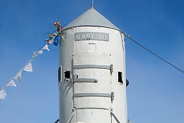
Triglav has long stood for Slovene identity. Chamois hunters first reached the summit in 1778. In 1895 the priest Jakob Aljaž bought the summit for one florin and put up the small metal shelter, still called Aljaž Tower, that marks the top today. Local folklore tells of Zlatorog, a white chamois with golden horns that guarded a treasure in these mountains. You will see its image on signs and beer labels across the region.
The First World War left deep marks. From 1915 to 1917 the Isonzo Front ran along the Soča, and the peaks around Krn were fought over at high altitude. Trenches, tunnels and military cemeteries still line the trails. On the Bovec side, the Austrian Kluže Fortress guarded the Koritnica gorge. North of the Vršič Pass, Russian prisoners of war built the road under forced labour. Avalanches in 1916 and 1917 killed more than a hundred of them, and the wooden Russian Chapel they built stands as their memorial.
In the Trenta valley, a monument to the climber and writer Julius Kugy looks towards the peaks he wrote about. He also advised on the founding of the nearby alpine garden.
Στοιχεία για τη χώρα
Quick practical facts for Slovenia at a glance:
- Νόμισμα
- Ευρώ EUR · Πληρωμές με κάρτα · Ευρέως αποδεκτές
- Τηλέφωνα έκτακτης ανάγκης
- 112
- Ηλεκτρικό ρεύμα
- 230 V · 50 HzΤύπος C / Τύπος F
- Γλώσσες
- Σλοβενικά
- Νερό βρύσης
- Πόσιμο
- Πλευρά οδήγησης
- Δεξιά
- Κωδικός κλήσης
- +386


Εθνικό Πάρκο Τρίγκλαβ – Σχεδίασε τις ημέρες σου
Μετάτρεψε τα μέρη από αυτόν τον οδηγό σε ένα πραγματικό δρομολόγιο, με έξυπνη δρομολόγηση, εκτιμήσεις χρόνου και όλα όσα χρειάζεσαι για ένα τέλειο ταξίδι.


Σχετικοί προορισμοί



Data: © OpenStreetMap contributors, Wikidata, Wikipedia, Tripomatic, Official websites. Tours by GetYourGuide. We earn commission from bookings. Travel guide generated with AI.
Σχεδίασε το ταξίδι σου με το Tripomatic
- Σχεδιασμός με AIΆφησε το AI να δημιουργήσει το δρομολόγιό σου, να απαντήσει σε ταξιδιωτικές ερωτήσεις και να αρχειοθετήσει τα έγγραφα των κρατήσεών σου στο ταξίδι σου.
- Ταξιδιωτικές ειδοποιήσειςΕπίσημες ταξιδιωτικές οδηγίες, έντονα καιρικά φαινόμενα, απεργίες και φυσικοί κίνδυνοι για τα μέρη σε κάθε ημέρα του ταξιδιού σου.
- Επίσημες αργίες & ΕκδηλώσειςΔες αργίες, φεστιβάλ και ημέρες μη λειτουργίας κατά τις ημέρες του ταξιδιού σου και πώς επηρεάζουν τα σχέδιά σου.
- Εκτίμηση κόστουςΑνάλυση του κόστους του ταξιδιού με AI, ώστε να γνωρίζεις τον προϋπολογισμό σου πριν ξεκινήσεις.
- Περιηγήσεις & ΕισιτήριαΚλείσε περιηγήσεις, εισιτήρια χωρίς αναμονή στην ουρά και δραστηριότητες απευθείας στο πλάνο σου.