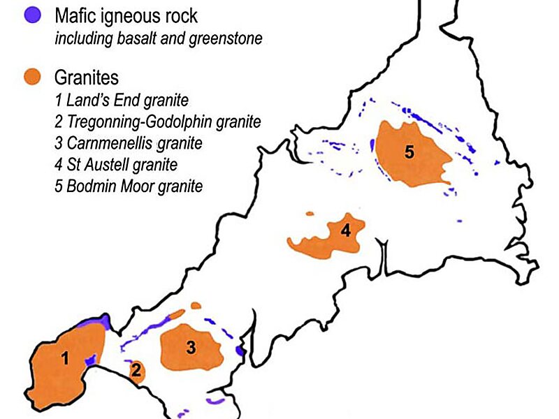
Bodmin Moor is a granite moorland in northeastern Cornwall, England. It is 208 square kilometres in size, and dates from the Carboniferous period of geological history. It includes Brown Willy, the highest point in Cornwall, and Rough Tor, a slightly lower peak. Many of Cornwall's rivers have their sources here. It has been inhabited since at least the Neolithic era, when primitive farmers started clearing trees and farming the land. They left their megalithic monuments, hut circles and cairns, and the Bronze Age culture that followed left further cairns, and more stone circles and stone rows. By medieval and modern times, nearly all the forest was gone and livestock rearing predominated.
The name Bodmin Moor is relatively recent. An early mention is in the Royal Cornwall Gazette of 28 November 1812. The upland area was formerly known as Fowey Moor after the River Fowey, which rises within it.
Wikipedia https://en.wikipedia.org/wiki/Bodmin_Moor
Official Website http://www.bodminmoor.co.uk/
Coordinates 50°32'52.205" N -4°33'44.522" E