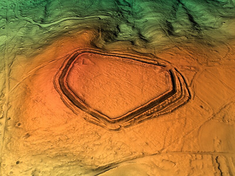
Castle Ring
Castle Ring is an Iron Age hill fort, situated high up on the southern edge of Cannock Chase, Staffordshire, England.
archaeological sitefortificationpeak

Riverside Hotel

Castle Ring
2h

Corner Café
45 min
Riverside Hotel
Add Castle Ring to Your Trip
Create a detailed travel itinerary with smart routing, time estimates, and everything you need for a perfect trip.
3M+ downloads · 4.6 stars · 15 years of trip planning


More Information and Contact
Wikipedia en.wikipedia.org/wiki/Castle_Ring
Address WS15 4, United Kingdom
Coordinates 52°42'47.292" N, 1°56'8.919" W
Riverside Hotel
Castle Ring
2h
Corner Café
45 min
Riverside Hotel
Add Castle Ring to Your Trip
Create a detailed travel itinerary with smart routing, time estimates, and everything you need for a perfect trip.
3M+ downloads · 4.6 stars · 15 years of trip planning