Chilkoot Pass
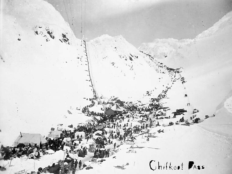
Chilkoot Pass is a high mountain pass through the Boundary Ranges of the Coast Mountains in the U.S. state of Alaska and British Columbia,… Read more…


Add Chilkoot Pass to Your Trip
Create a detailed travel itinerary with smart routing, time estimates, and everything you need for a perfect trip.


Chilkoot Pass is a high mountain pass through the Boundary Ranges of the Coast Mountains in the U.S. state of Alaska and British Columbia, Canada. It is the highest point along the Chilkoot Trail that leads from Dyea, Alaska to Bennett Lake, British Columbia. The Chilkoot Trail was long a route used by the Tlingit for trade.
During the Klondike Gold Rush of the late 19th century, it was used by prospectors and packers to get through the mountains. During the gold rush, three aerial tramways and several surface hoists were constructed and operated briefly over the pass. When the White Pass and Yukon Route Railroad was built in neighboring White Pass, the Chilkoot Pass route fell out of favor with miners.
Source: Wikipedia
More Information and Contact
Add Chilkoot Pass to Your Trip
Create a detailed travel itinerary with smart routing, time estimates, and everything you need for a perfect trip.