Druidenstein
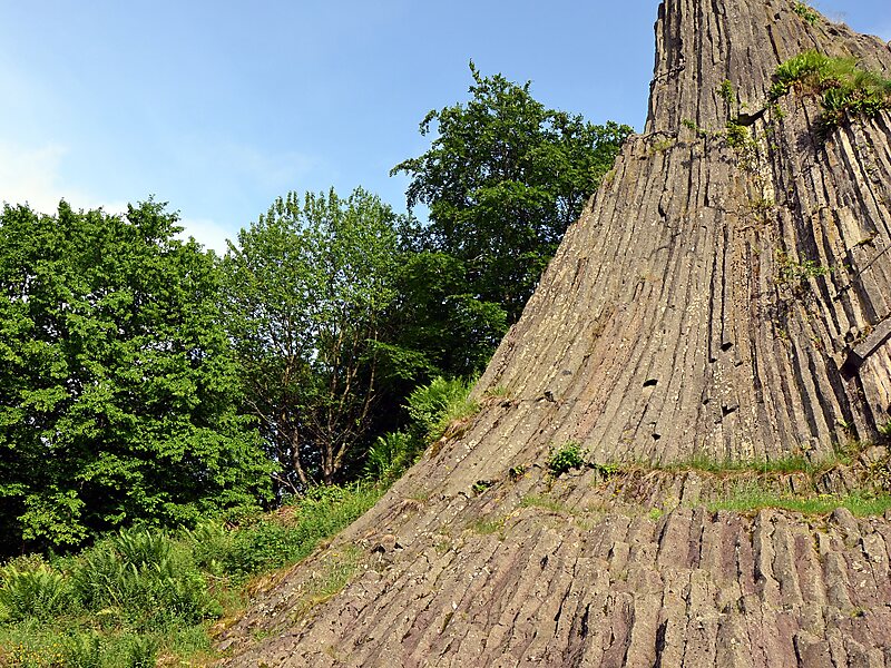
The Druidenstein is a cone-shaped basalt rock in the northern Heller Upland above the town of Kirchen on the Sieg in the parish of… Read more…
peak

Riverside Hotel

Druidenstein
2h

Corner Café
45 min
Riverside Hotel
Add Druidenstein to Your Trip
Create a detailed travel itinerary with smart routing, time estimates, and everything you need for a perfect trip.
3M+ downloads · 4.6 stars · 15 years of trip planning


The Druidenstein is a cone-shaped basalt rock in the northern Heller Upland above the town of Kirchen on the Sieg in the parish of Herkersdorf, Altenkirchen, Germany. The basalt cone stands at a height 431 m above sea level and is about 20 metres high.
Source: Wikipedia
More Information and Contact
Wikipedia en.wikipedia.org/wiki/Druidenstein
Address (Unnamed Road), 57548, Germany
Coordinates 50°47'42.014" N, 7°54'37.306" E
Riverside Hotel
Druidenstein
2h
Corner Café
45 min
Riverside Hotel
Add Druidenstein to Your Trip
Create a detailed travel itinerary with smart routing, time estimates, and everything you need for a perfect trip.
3M+ downloads · 4.6 stars · 15 years of trip planning