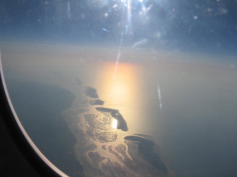
The East Frisian Islands are a chain of islands in the North Sea, off the coast of East Frisia in Lower Saxony, Germany. The islands extend for some 90 kilometres from west to east between the mouths of the Ems and Jade / Weser rivers and lie about 3.5 to 10 km offshore. Between the islands and the mainland are extensive mudflats, known locally as Watten, which form part of the Wadden Sea. In front of the islands are Germany's territorial waters, which occupy a much larger area than the islands themselves. The islands, the surrounding mudflats and the territorial waters form a close ecological relationship. The island group makes up about 5% of the Lower Saxony Wadden Sea National Park.
The largest island by surface area is Borkum, located at the western end of the chain; the other six inhabited islands are from west to east: Juist, Norderney with the largest town in the islands, Baltrum, Langeoog, Spiekeroog and Wangerooge.
Wikipedia https://en.wikipedia.org/wiki/East_Frisian_Islands
Coordinates 53°41'48.899" N 7°16'47.1" E