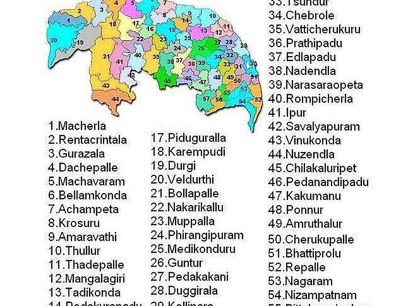
Guntur district is an administrative district in the Coastal Andhra region of the Indian state of Andhra Pradesh. The administrative seat of the district is located at Guntur, the largest city of the district in terms of area and population. It has a coastline of approximately 100 km and is situated on the right bank of Krishna River, that separates it from Krishna district and extends till it empties into the Bay of Bengal. It is bounded on the south by Prakasam district and on the west by the state of Telangana. It has an area of 11,391 km2 and is the 2nd most populous district in the state, with a population of 4,889,230 as per 2011 census of India.The district is often referred to as the Land of Chillies. It is also a major centre for agriculture, education and learning. It exports large quantities of chillies and tobacco. Amaravati, the proposed capital of Andhra Pradesh is situated in Guntur district, on the banks of River Krishna.
Download Download See moreWikipedia https://en.wikipedia.org/wiki/Guntur_district
Coordinates 16°17'29.468" N 80°27'14.971" E