Hermannskogel
Vienna, 🇦🇹 Austria
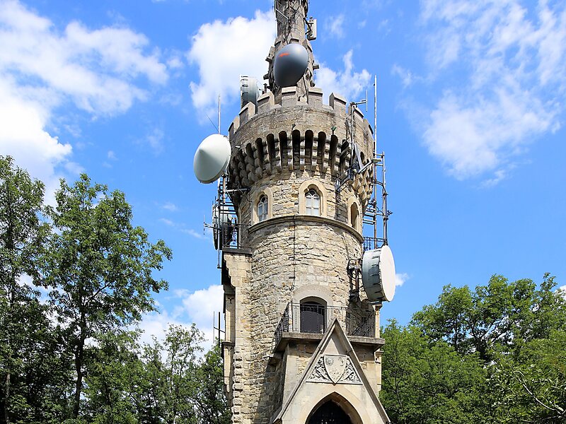
The Hermannskogel is a hill in Döbling, the 19th district of Vienna. At 542 metres above sea level, it is the highest natural point of… Read more…
peak

Riverside Hotel

Hermannskogel
2h

Corner Café
45 min
Riverside Hotel
Add Hermannskogel to Your Trip
Create a detailed travel itinerary with smart routing, time estimates, and everything you need for a perfect trip.
3M+ downloads · 4.6 stars · 15 years of trip planning


The Hermannskogel is a hill in Döbling, the 19th district of Vienna. At 542 metres above sea level, it is the highest natural point of Vienna. It lies on the border to Lower Austria.
The Habsburgwarte, standing atop the Hermannskogel, marked the kilometre zero in cartographic measurements used in Austria-Hungary until 1918.
Source: Wikipedia
More Information and Contact
Wikipedia en.wikipedia.org/wiki/Hermannskogel
Wikipedia de.wikipedia.org/wiki/Hermannskogel
Address 1190, Austria
Coordinates 48°16'14.565" N, 16°17'40.484" E
Riverside Hotel
Hermannskogel
2h
Corner Café
45 min
Riverside Hotel
Add Hermannskogel to Your Trip
Create a detailed travel itinerary with smart routing, time estimates, and everything you need for a perfect trip.
3M+ downloads · 4.6 stars · 15 years of trip planning