The Ikara–Flinders Ranges National Park, formerly Flinders Ranges National Park, is situated approximately 400 km north of Adelaide in the northern central part of South Australia's largest mountain range, the Flinders Ranges. The park covers an area of 912 km², northeast of the small town of Hawker. The Heysen Trail and Mawson Trails pass through the park.
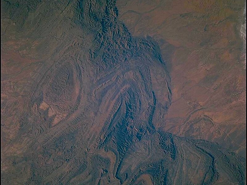
The park's most characteristic landmark is Wilpena Pound, a large, sickle-shaped, natural amphitheatre covering nearly 80 km², containing the range's highest peak, St Mary Peak. On 12 February 2016 the park was renamed to include the Adnyamathanha word, Ikara, "meeting place", referring to the traditional name for Wilpena Pound.The park centre at Wilpena Pound is accessible by sealed road from Hawker.
Wikipedia https://en.wikipedia.org/wiki/Ikara-Flinders_Ranges_National_Park
Official Website https://www.environment.sa.gov.au/parks/Find_a_Park/Browse_by_region/flinders-ranges-outback/ikara-flinders-ranges-national-park
Coordinates -31°23'27.585" N 138°39'34.01" E
