La Strada dell'Assietta
The Strada dell'Assietta, also known as Strada Provinciale 173 del Colle dell'Assietta, is a 34 km-long dirt road between Sestriere and the… Read more…


Add La Strada dell'Assietta to Your Trip
Create a detailed travel itinerary with smart routing, time estimates, and everything you need for a perfect trip.


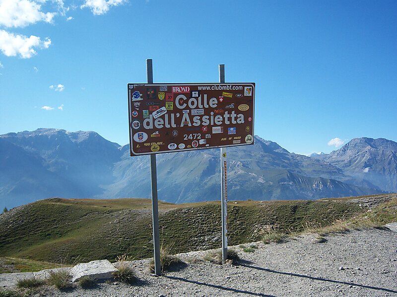
The Strada dell'Assietta, also known as Strada Provinciale 173 del Colle dell'Assietta, is a 34 km-long dirt road between Sestriere and the SP 172 at Pian dell'Alpe, near the Colle delle Finestre.
The road is almost entirely above 2000 metres altitude and so is only open from June 1 to October 31. It runs along the ridge that separates the Val Chisone and Susa valley and passes several mountain passes between these valleys including Colle dell'Assietta, Colle Blegier, Colle Costa Piana, Colle Bourget and Col Basset.The road was built in the late 1800s for military purposes, and the ruins of forts still remain. Today, some farmers use the road to access their land, but the primary use is by tourists, particularly people on touring motorbikes and mountain bikes.
Source: Wikipedia
More Information and Contact
Add La Strada dell'Assietta to Your Trip
Create a detailed travel itinerary with smart routing, time estimates, and everything you need for a perfect trip.