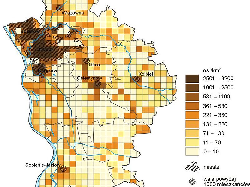
Otwock County is a unit of territorial administration and local government in Masovian Voivodeship, east-central Poland. It came into being on January 1, 1999, as a result of the Polish local government reforms passed in 1998. Its administrative seat and largest town is Otwock, which lies 22 kilometres south-east of Warsaw. The county also contains the towns of Józefów, lying 3 km north-west of Otwock, and Karczew, 4 km south of Otwock.
The county covers an area of 615.09 square kilometres. As of 2019 its total population is 124,241, out of which the population of Otwock is 44,827, that of Józefów is 20,698, that of Karczew is 9,856, and the rural population is 48,860.
Wikipedia https://en.wikipedia.org/wiki/Otwock_County
Official Website http://www.powiat-otwocki.pl/
Coordinates 52°6'14.831" N 21°16'5.193" E
