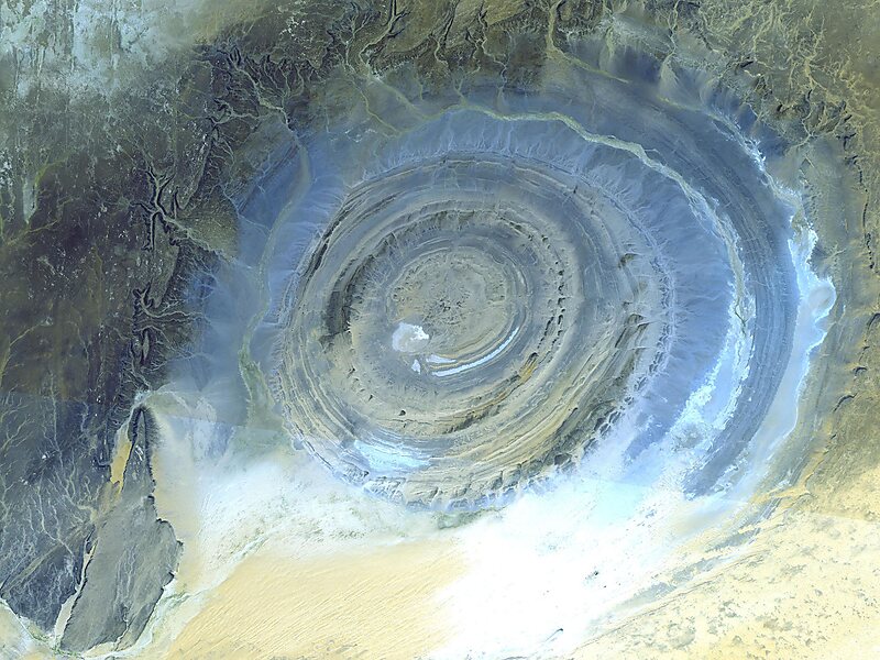
The Richat Structure, or Guelb er Richât, is a prominent circular geological feature in the Adrar Plateau of the Sahara. It is located near Ouadane in the Adrar Region of Mauritania. In Hassaniya Arabic, rīšāt means feathers and it is also known locally in Arabic as tagense, referring to the circular opening of the leather pouch that is used to draw water from local wells.
It is an eroded geological dome, 40 kilometres in diameter caused by a subsurface igneous intrusion deforming the overlying sedimentary rock layers, causing the rock to be exposed as concentric rings with the oldest layers exposed at the centre of the structure. Igneous rock is exposed inside and there are rhyolites and gabbros that have undergone hydrothermal alteration, and a central megabreccia.
Wikipedia https://en.wikipedia.org/wiki/Richat_Structure
Address Mauritania
Coordinates 21°6'31.105" N -11°23'45.015" E