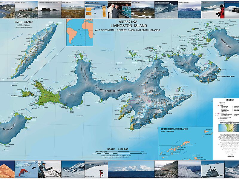
Robert Island or Mitchells Island or Polotsk Island or Roberts Island is an island 11 miles long and 8 miles wide, situated between Nelson Island and Greenwich Island in the South Shetland Islands, Antarctica. Robert Island is located at 62°24′S 59°30′W. Surface area 132 km2. The name "Robert Island" dates back to around 1821 and is now established in international usage.
Much of the Coppermine Peninsula in the west of the island is made up by a perched strandflat surface that was in past at sea level.Captain Richard Fildes may have named Robert Island for his brig Robert. Fildes was sealing in the South Shetlands in 1821–1822 until ice destroyed his vessel in March 1822. Fildes Strait is named for him.
Wikipedia https://en.wikipedia.org/wiki/Robert_Island
Coordinates -62°23'42.971" N -59°31'3.118" E