Rongelap Atoll
Rongelap Atoll RONG-gə-lap is an uninhabited coral atoll of 61 islands in the Pacific Ocean, and forms a legislative district of the Ralik… Read more…


Add Rongelap Atoll to Your Trip
Create a detailed travel itinerary with smart routing, time estimates, and everything you need for a perfect trip.


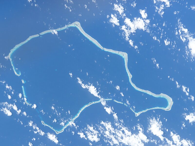
Rongelap Atoll RONG-gə-lap is an uninhabited coral atoll of 61 islands in the Pacific Ocean, and forms a legislative district of the Ralik Chain of the Marshall Islands. Its total land area is 8 square miles. It encloses a lagoon with an area of 1,000 square miles. It is historically notable for its close proximity to US hydrogen bomb tests in 1954, and was particularly devastated by fallout from the Castle Bravo test. The population asked the US to move them from Rongelap following the test due to high radiation levels, but with no success; so they asked global environmental group Greenpeace to help. The Rainbow Warrior made three trips moving the islanders, their possessions and over 100 tons of building materials to the island of Mejato in the Kwajalein Atoll, 180 kilometers away.
Source: Wikipedia
More Information and Contact
Add Rongelap Atoll to Your Trip
Create a detailed travel itinerary with smart routing, time estimates, and everything you need for a perfect trip.