Saddleworth Moor is a moorland in North West England. Reaching more than 1,312 feet above sea level, it is in the Dark Peak area of the Peak District National Park. It is crossed by the A635 road and the Pennine Way passes to its eastern side.
Download Download See more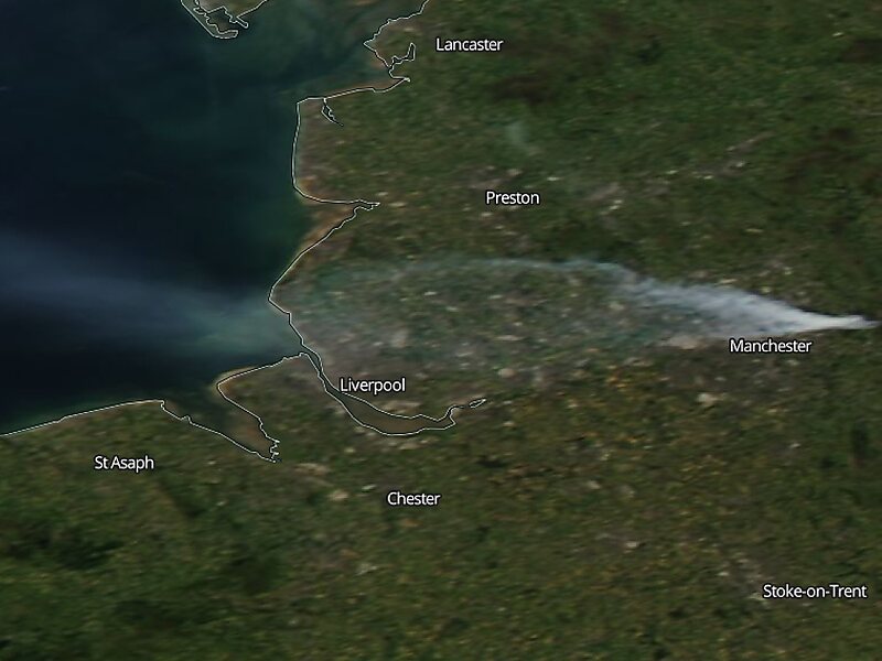
Wikipedia https://en.wikipedia.org/wiki/Saddleworth_Moor
Address OL3 5, United Kingdom
Coordinates 53°37'39.815" N -2°1'30.71" E
