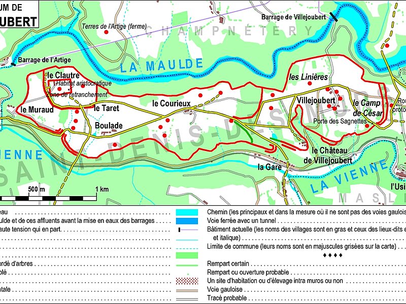
Saint-Denis-des-Murs is a commune in the Haute-Vienne department in the Nouvelle-Aquitaine region in west-central France. It is situated in the Limousin region, in the southern-centre of France at 24 kilometres from Limoges, the department capital.
Popular places to visit nearby include Saint-Leonard-de-Noblat at 7 km and Pierre-Buffiere at 17 km.
Wikipedia https://en.wikipedia.org/wiki/Saint-Denis-des-Murs
Coordinates 45°47'6.177" N 1°32'36.398" E