The Stad Ship Tunnel is a proposed canal and tunnel to bypass the Stad peninsula in Selje Municipality in Sogn og Fjordane county, Norway. The peninsula is one of the most exposed areas on the coast, without any outlying islands to protect it from the weather. The section has traditionally been one of the most dangerous along the coast of Norway.Two paths have been proposed: one 1,800 meters long from the Eide farm at the inner part of the Moldefjorden through the Mannseidet isthmus to the Kjødspollen, the narrowest but innermost place of the peninsula.
Download Download See more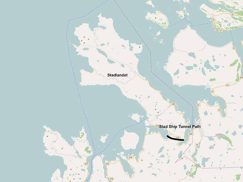
Wikipedia https://en.wikipedia.org/wiki/Stad_Ship_Tunnel
Coordinates 62°0'43.891" N 5°26'21.66" E
