Waterfront Station
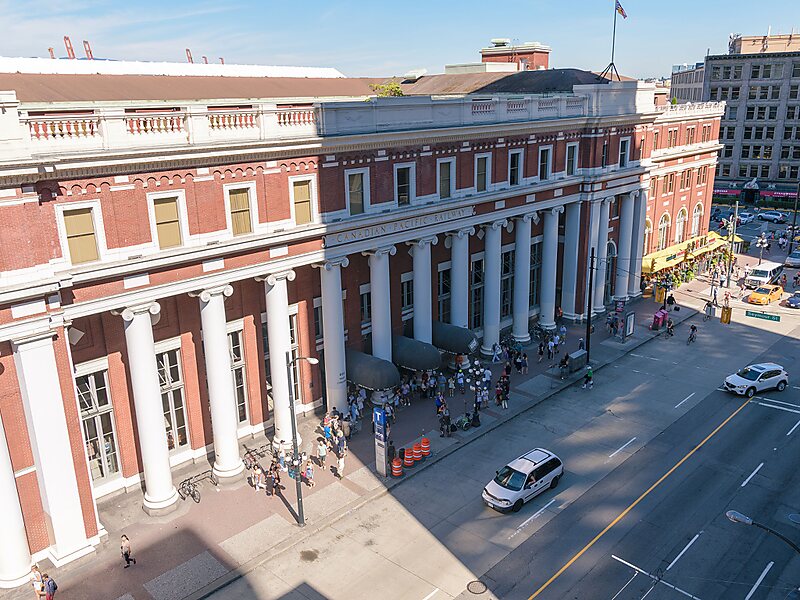
Waterfront station is a major intermodal public transportation facility and the main transit terminus in Vancouver, British Columbia,… Read more…


Add Waterfront Station to Your Trip
Create a detailed travel itinerary with smart routing, time estimates, and everything you need for a perfect trip.


Waterfront station is a major intermodal public transportation facility and the main transit terminus in Vancouver, British Columbia, Canada. It is on West Cordova Street in Downtown Vancouver, between Granville and Seymour Street. The station is also accessible via two other street-level entrances, one on Howe Street to the west for direct access to the Expo Line and another on Granville Street to the south for direct access to the Canada Line.
The station is within walking distance of Vancouver's historical Gastown district, Canada Place, Vancouver Convention Centre, Harbour Centre, Sinclair Centre, and the Vancouver Harbour Flight Centre float plane terminal. A heliport operated by Helijet, along with the downtown campuses for Simon Fraser University and the British Columbia Institute of Technology, are also located within the vicinity of the station.
Source: Wikipedia
More Information and Contact
Add Waterfront Station to Your Trip
Create a detailed travel itinerary with smart routing, time estimates, and everything you need for a perfect trip.