


Ischgl
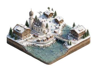
Ischgl is a high-altitude ski village at the head of the Paznaun valley in Tyrol. Together with Samnaun in Switzerland, it forms the Silvretta Arena, a large ski area that crosses the border. The area is known for its snow reliability, modern lifts and lively nightlife.
In summer the village is quieter. It offers hiking, mountain biking and high-alpine scenery in the Silvretta range.

Ischgl – Suunnitteletko matkaa?
Rakenna päiväkohtainen matkasuunnitelmasi Tripomatic-sovelluksessa.


Milloin matkustaa
Ski season runs from late November to early May. The area hosts big concerts at the season opening and closing. July to September is best for hiking, though many lifts open only in part. May and October are quiet. Winters are cold and snowy.
Päänähtävyydet
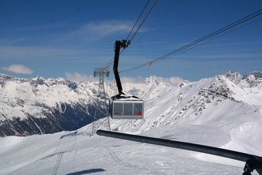

- Hängebrücke Bärenfalle is a suspension bridge over a gorge, reached on a short walk.
- Sankt Nikolaus is the village church, with a baroque interior.
- Seilbahnmuseum tells the story of the area's cable cars and skiing.
- Wildpark Ischgl is a small wildlife park on the edge of the village.
- Piz Val Gronda is a mountain on the ski area above Ischgl, at about 2,800 m.
- Saumspitze is a peak in the Verwall range, reached on summer hikes.
- Samnaun, the Swiss duty-free village at the end of the ski area, is reached by lift from the Ischgl side in winter.
Suositellut listat

Ischgl Essentials
Ischgl anchors the Silvretta Arena, one of the largest cross-border ski areas connecting Austria to Samnaun, Switzerland. This selection highlights the 239 kilometers of slopes accessible via high-tech infrastructure like the heated Palinkopfbahn and the Piz Val Gronda cable car. The list covers essential valley landmarks, from the 120-meter Kitzloch suspension bridge to Michelin-starred dining at Paznaunerstube and the high-altitude culinary hub at Idalp. It also features the village's established après-ski venues and luxury wellness facilities.
12 paikkaaMitä kokea
- Ski across the border to Samnaun.
- Hike the Silvretta trails in summer.
- Visit a mountain hut for lunch.
- Take a bike tour on the valley trails.
- Enjoy après-ski in the village.
Kierrokset ja aktiviteetit
Ischgl — Kartta

Päiväretket
Missä vierailla
Saapuminen
- By air: Innsbruck Airport is about 1 hour 45 minutes by road. Zurich and Munich are also used.
- By train: The closest station is Landeck-Zams, with a bus of about 45 minutes to Ischgl. Check times on ÖBB.
- By car: Ischgl is reached from the A12 motorway at Landeck via the B188 road.
Liikkuminen paikan päällä
The village is small, and most hotels are near the lifts. Ski buses run in winter. A regional bus goes through the valley. Gondolas leave from the village centre.
Autoilu
A car is not needed in winter. Winter tyres or chains are required in snow. The road up the Paznaun valley can close in heavy snow. Motorways in Austria need a vignette.
Ruoka ja juoma
Tyrolean food is hearty: Kasspatzln, Tiroler Gröstl and Kaiserschmarrn. Mountain restaurants range from simple huts to gourmet venues. The village has a lively dining and bar scene in winter.
Turvallisuus ja terveys
Ischgl is safe. Avalanche risk is real off-piste, so check bulletins and use a guide. Stay on marked runs otherwise. Altitude can cause headaches for some visitors. Tap water is clean and safe to drink. The emergency number is 112. The mountain rescue number is 140.
Historia
Ischgl was a poor farming village until the first ski lifts opened in the 1960s. It grew into a major resort with the Silvretta Arena, which opened to Samnaun in Switzerland in the 1960s and 1970s. It is known for large concerts at the opening and closing of the ski season.
Tietoa maasta
Quick practical facts for Austria at a glance:
- Valuutta
- euro EUR € · Korttimaksut · Yleisesti hyväksytty
- Hätänumerot
- 112
- Sähkö
- 230 V · 50 HzTyyppi C / Tyyppi F
- Kielet
- saksa
- Hanavesi
- Juomakelpoista
- Ajosuunta
- Oikea
- Suuntanumero
- +43

Ischgl – Suunnittele päiväsi
Muunna tämän oppaan paikat todelliseksi matkasuunnitelmaksi älykkäillä reiteillä, aika-arvioilla ja kaikella, mitä tarvitset onnistuneeseen matkaan.


Liittyvät määränpäät
Data: © OpenStreetMap contributors, Wikidata, Wikipedia, Tripomatic, Official websites, geoBoundaries (CC BY 4.0). Tours by GetYourGuide. We earn commission from bookings. Travel guide generated with AI.
Suunnittele matkasi Tripomaticilla
- Tekoälypohjainen suunnitteluAnna tekoälyn rakentaa matkasuunnitelmasi, vastata matkakysymyksiin ja arkistoida varausasiakirjasi matkaasi.
- MatkustustiedotteetViralliset tiedotteet, vaaralliset säät, lakot ja luonnonkatastrofit matkasi jokaisen päivän paikkoihin.
- Juhlapyhät ja tapahtumatNäe matkasi päiville osuvat lomat, festivaalit ja sulkuajat sekä niiden vaikutus suunnitelmiisi.
- KustannusarvioTekoälypohjaiset matkakustannuserittelyt auttavat sinua hahmottamaan budjetin ennen lähtöä.
- Kierrokset ja liputVaraa kierroksia, jonon ohi -lippuja ja aktiviteetteja suoraan suunnitelmaasi.