



Kitzbühel
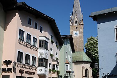
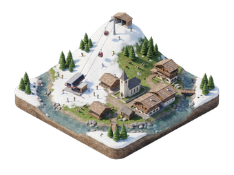
Kitzbühel is a medieval town in the Tyrolean Alps that has become one of Europe's best-known ski resorts. It has a pastel old town, a lively social scene and a mountain on its doorstep.
The Hahnenkamm race, the Streif downhill, is a highlight of the ski World Cup every January. In summer, the area turns to hiking, cycling and swimming in nearby lakes.

Kitzbühel – Suunnitteletko matkaa?
Rakenna päiväkohtainen matkasuunnitelmasi Tripomatic-sovelluksessa.


Milloin matkustaa
December to March is ski season, and the Hahnenkamm races take place in January. June to September is good for hiking, cycling and lake swimming. April–May and October–November are quiet, with some lifts and hotels closed. Winter is cold and snowy. Summer is mild.
Päänähtävyydet
- Hahnenkamm is the main ski mountain, home to the Streif downhill. In summer it is a hiking area.
- Kitzbüheler Horn is a second mountain with a toll road, cable car and a flower-rich summit.
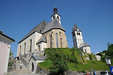
- Pfarrkirche Zum Heiligen Andreas is the parish church in the old town, with a Gothic structure.
- The Liebfrauenkirche is the church above the old town, which has two levels.
- Museum Kitzbühel shows local history, art and winter sports.
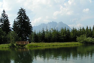
- Strandbad Schwarzsee is a small lake with a warm beach and a good swimming spot.
- Alpenblumengarten is an alpine flower garden on the Kitzbüheler Horn.
- Schleierwasserfall is a waterfall near town, reached on a short walk.
Suositellut listat

Mitä kokea
- Ski or ride the lifts up the Hahnenkamm.
- Walk or drive up to the Kitzbüheler Horn for summit views.
- Swim at Schwarzsee in summer.
- Hike a Gipfelrunde on the Kitzbüheler Alpen trail network.
- Walk the old town shops and cafes in the evening.
Kierrokset ja aktiviteetit
Kitzbühel — Kartta

Päiväretket
- Zell am See is a lake town with a ski mountain, about 45 minutes by car.
- Saalbach is a big ski area in Salzburgerland, about 45 minutes by car.
- Innsbruck is about 1 hour 15 minutes by train.
- Salzburg is about 1 hour 15 minutes by car.
- The Grossglockner High Alpine Road is a scenic mountain road reached in about 1 hour by car in the summer season.
Missä vierailla
- Zell am See and Saalbach are the closest preferred destinations.
Saapuminen
- By air: Innsbruck and Salzburg airports are both about 1 hour 15 minutes away by car. Munich is about 2 hours.
- By train: Kitzbühel has two stations. Direct trains from Innsbruck take about 1 hour 15 minutes, and Salzburg takes about 2 hours with a change. Check times on ÖBB.
- By car: Kitzbühel is reached via the Inn valley and the B170 road.
Liikkuminen paikan päällä
The town is small and walkable. Free ski buses run in winter. Local buses reach the lakes and valley stations. Cable cars leave from the edge of town.
Autoilu
A car is not needed in town. It helps for the lake and side valleys. Winter tyres or chains are required in snow. Parking in the old town is limited and metered. Motorways in Austria need a vignette.
Ruoka ja juoma
Tyrolean food is hearty, with Kasspatzln, Tiroler Gröstl and Kaiserschmarrn. Many mountain huts serve simple dishes. The town has many fine restaurants, bars and a lively après-ski scene in winter.
Turvallisuus ja terveys
Kitzbühel is very safe. On the slopes, stay on marked runs and follow avalanche warnings. Tap water is clean and safe to drink. The emergency number is 112. The mountain rescue number is 140.
Historia
Kitzbühel was a mining town in the Middle Ages, with copper and silver mines nearby. It received town rights in 1271. Skiing arrived in 1893, when a local brought the first skis from Norway. The Hahnenkamm race began in 1931 and became a classic.
Tietoa maasta
Quick practical facts for Austria at a glance:
- Valuutta
- euro EUR € · Korttimaksut · Yleisesti hyväksytty
- Hätänumerot
- 112
- Sähkö
- 230 V · 50 HzTyyppi C / Tyyppi F
- Kielet
- saksa
- Hanavesi
- Juomakelpoista
- Ajosuunta
- Oikea
- Suuntanumero
- +43


Kitzbühel – Suunnittele päiväsi
Muunna tämän oppaan paikat todelliseksi matkasuunnitelmaksi älykkäillä reiteillä, aika-arvioilla ja kaikella, mitä tarvitset onnistuneeseen matkaan.


Liittyvät määränpäät


Data: © OpenStreetMap contributors, Wikidata, Wikipedia, Tripomatic, Official websites, geoBoundaries (CC BY 4.0). Tours by GetYourGuide. We earn commission from bookings. Travel guide generated with AI.
Suunnittele matkasi Tripomaticilla
- Tekoälypohjainen suunnitteluAnna tekoälyn rakentaa matkasuunnitelmasi, vastata matkakysymyksiin ja arkistoida varausasiakirjasi matkaasi.
- MatkustustiedotteetViralliset tiedotteet, vaaralliset säät, lakot ja luonnonkatastrofit matkasi jokaisen päivän paikkoihin.
- Juhlapyhät ja tapahtumatNäe matkasi päiville osuvat lomat, festivaalit ja sulkuajat sekä niiden vaikutus suunnitelmiisi.
- KustannusarvioTekoälypohjaiset matkakustannuserittelyt auttavat sinua hahmottamaan budjetin ennen lähtöä.
- Kierrokset ja liputVaraa kierroksia, jonon ohi -lippuja ja aktiviteetteja suoraan suunnitelmaasi.