


La Gomera
La Gomera is a small, round island of about 370 km². It has around 22,000 residents and is cut by deep ravines called barrancos. The terrain is steep, so villages sit far apart and the pace is slow. The island suits walkers and travelers who want quiet more than resorts.
The center is covered by a laurel forest that is a UNESCO World Heritage Site. Islanders also kept a whistled language, Silbo Gomero, that was made for calling across the ravines. Most visitors come to hike, drive the mountain roads and relax in the green north or the dry, sunny coast.

La Gomera – Suunnitteletko matkaa?
Rakenna päiväkohtainen matkasuunnitelmasi Tripomatic-sovelluksessa.


Milloin matkustaa
The coast is dry and sunny for much of the year. The forested center and the north are cooler and wetter, so bring a light jacket for walks.
The biggest event is the fiesta of the island's patron saint, the Virgin of Guadalupe, in early October. Every five years, the statue is taken by boat from her chapel in Puntallana to San Sebastián and then carried around the island.
Paras aika matkustaa: tammikuu, helmikuu, maaliskuu, huhtikuu, toukokuu, kesäkuu, heinäkuu, elokuu, syyskuu, lokakuu, marraskuu, joulukuu
Päänähtävyydet


- Alto de Garajonay is the island's highest point, at 1,487 m, inside the national park. It has wide views on clear days.
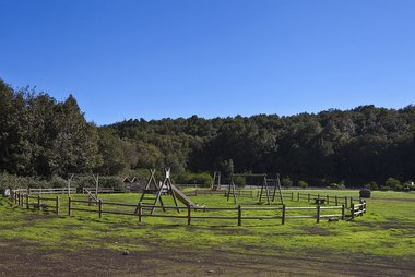
- Laguna Grande is the main base for walks in the forest. A small information point and a self-guided trail start here.
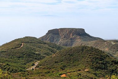
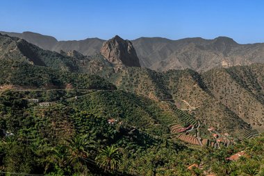
- Roque de Agando is a tall volcanic plug beside the main road from San Sebastián to the park. It rises to about 1,250 m. Climbing is restricted, so enjoy it from the road and nearby paths.
- Valle Gran Rey is the main valley of the west coast. It has several small villages along a long, steep valley.
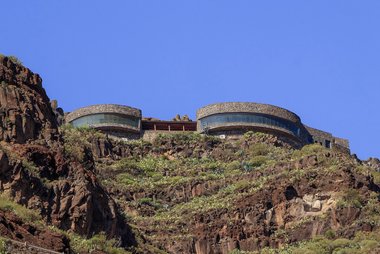
- Mirador de Abrante is a viewpoint above the village of Agulo. It has a glass floor.
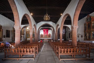
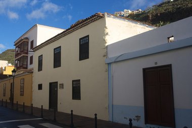
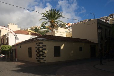
- In San Sebastián, Torre del Conde, Casa de Colón and Iglesia de la Asunción stand close together near the harbor. The house is linked to Columbus, who stopped here in 1492.
Suositellut listat

Mitä kokea
- Hear Silbo Gomero: This whistled language is taught in all the island's schools. Demonstrations are sometimes offered; ask at the tourist office.
- Walk in the laurel forest: The national park has 18 footpaths. Start with the self-guided trail at Laguna Grande.
- Visit the park visitor center: It is at Juego de Bolas, near Agulo, and is open daily from 9:30 to 16:30. It has exhibitions, a garden of local plants and a craft shop.
- Take a boat to Los Órganos: This cliff of basalt columns can only be seen from the sea. Boat trips run from the south and west coast; ask locally.
- Walk onto the glass floor at Mirador de Abrante: The viewpoint hangs over the valley above Agulo.
- Hike the long island loop: The GR 132 trail circles the island from San Sebastián. It is about 127 km long and is demanding. Most visitors walk only a stage or two.
Kierrokset ja aktiviteetit
La Gomera — Kartta

Päiväretket
La Gomera is a small island, and its day trips are by sea. Plan a full day, and check the last ferry back before you go.
Missä vierailla
La Gomera is easy to combine with the other Canary Islands.
- For ferry links: Tenerife and La Palma.
- Other islands: El Hierro and Gran Canaria.
Saapuminen
- By air: La Gomera Airport (GMZ) is in the south, about 34 km by road from San Sebastián. Binter Canarias flies between Tenerife North and La Gomera in under 30 minutes. Check bus and taxi options at the airport. Many visitors fly into Tenerife and take the ferry instead. Check flights at Binter Canarias.
- By ferry: Fred. Olsen Express sails from Los Cristianos on Tenerife to San Sebastián in about 50 minutes. Cars can be carried, but check the operator's rules and book ahead in busy periods. See Fred. Olsen Express for times. The San Sebastián port is a few minutes' walk from the center.
- Other islands: For La Palma, check current ferry and flight options with the operators.
Liikkuminen paikan päällä
- Bus: GuaguaGomera buses run between San Sebastián and the main towns from the bus station in San Sebastián. Services are less frequent than in cities, so check current times at the station.
- Car: A car gives the most freedom. See the driving section.
- Taxi: Useful for short trips and trailheads. Book ahead for early starts.
- On foot: Walking is the best way to see the forest. The island has a large network of marked footpaths. Bicycles are not allowed on the national park footpaths. For hiking maps and trail information, see La Gomera Tourism.
Autoilu
- Is a car worth it?: Yes, if you want to reach trailheads and villages in the north and center. The terrain is steep, so distances take longer than they look on the map.
- Bicycles: In the national park, bicycles are allowed on paved roads and most sand tracks, but not on footpaths.
- Ferry: Cars can be taken on the ferry from Tenerife. Check the operator's rules and book early.
Ruoka ja juoma
Look for local dishes made from simple island products. Almogrote is a strong cheese spread. Miel de palma is a dark syrup made from palm sap, and it is used on desserts and cheese. Gofio is a toasted-grain flour, and the porridge escaldón is made with it.
Eat in the villages and in San Sebastián around the harbor. Small family restaurants in the mountain villages often serve the island's classic dishes.
Turvallisuus ja terveys
La Gomera is a quiet island, and the main risks are on the trails. Paths in the forest can be wet, and cloud can hide the view, so wear boots and carry a light jacket.
- Fire: A forest fire in August 2012 burned about 18% of the national park. Do not smoke in the forest. Cooking stoves are allowed only in the official recreation areas, and only when the weather permits.
- Camping: Camping and bivouacking are not allowed in the national park. The only camping area is a private one in the hamlet of El Cedro.
- Trails: Stay on marked paths and take your rubbish with you.
Historia
La Gomera was the last port Columbus visited before he crossed the Atlantic in 1492. He planned to stay for four days and stayed for about a month. He sailed from San Sebastián on 6 September 1492. In town, Casa de Colón is the house where he is said to have stayed.
The first islanders used a whistled language, Silbo Gomero. UNESCO listed it as intangible cultural heritage in 2009.
Tietoa maasta
Quick practical facts for Spain at a glance:
- Valuutta
- euro EUR € · Korttimaksut · Laajasti hyväksytty
- Hätänumerot
- 112
- Sähkö
- 230 V · 50 HzTyyppi C / Tyyppi F
- Kielet
- espanja
- Hanavesi
- Juomakelpoista
- Ajosuunta
- Oikea
- Suuntanumero
- +34


La Gomera – Suunnittele päiväsi
Muunna tämän oppaan paikat todelliseksi matkasuunnitelmaksi älykkäillä reiteillä, aika-arvioilla ja kaikella, mitä tarvitset onnistuneeseen matkaan.


Liittyvät määränpäät


Data: © OpenStreetMap contributors, Wikidata, Wikipedia, Tripomatic, Official websites. Tours by GetYourGuide. We earn commission from bookings. Travel guide generated with AI.
Suunnittele matkasi Tripomaticilla
- Tekoälypohjainen suunnitteluAnna tekoälyn rakentaa matkasuunnitelmasi, vastata matkakysymyksiin ja arkistoida varausasiakirjasi matkaasi.
- MatkustustiedotteetViralliset tiedotteet, vaaralliset säät, lakot ja luonnonkatastrofit matkasi jokaisen päivän paikkoihin.
- Juhlapyhät ja tapahtumatNäe matkasi päiville osuvat lomat, festivaalit ja sulkuajat sekä niiden vaikutus suunnitelmiisi.
- KustannusarvioTekoälypohjaiset matkakustannuserittelyt auttavat sinua hahmottamaan budjetin ennen lähtöä.
- Kierrokset ja liputVaraa kierroksia, jonon ohi -lippuja ja aktiviteetteja suoraan suunnitelmaasi.