


Idrija
Idrija is a small mining town in a narrow green valley in western Slovenia. For 500 years it lived from mercury, and its old mine is the second largest mercury mine in the world. Together with Almadén in Spain, its mining heritage is on the UNESCO World Heritage List.
The town is easy to enjoy in a day or two, and its mining past is still visible above and below ground. Idrija is also famous for its fine bobbin lace and for žlikrofi, small filled dumplings. Forest trails, old timber dams and a deep spring lake lie just outside town, so the trip suits travellers who like history and easy walks.

Idrija – Suunnitteletko matkaa?
Rakenna päiväkohtainen matkasuunnitelmasi Tripomatic-sovelluksessa.


Milloin matkustaa
Late spring to early autumn is the best time. June and September are pleasant and good for walking. July and August are warm, with frequent afternoon showers, and autumn is the wettest season. Winters are cold, often with snow, and some sights have shorter hours.
The biggest annual event is the Idrija Lace Festival in June. For a long weekend, the town fills with lace exhibitions, demonstrations and a lace-making contest, and the streets have a festive feel. In Advent, the smaller Perkmandlc festival celebrates the mine's legendary sprite.
Paras aika matkustaa: kesäkuu, syyskuu
Päänähtävyydet


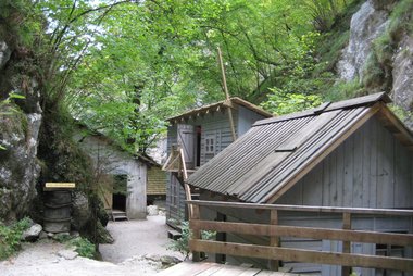
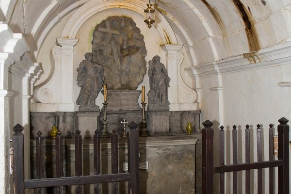
Anthony's Mine Shaft is the oldest preserved entrance to the mine, dug in 1500. A guided tour leads you through a 300 m gallery lined with stone, past an underground chapel, and shows how miners dug ore by hand. Tours run several times a day, but only at weekends in December, January and February. The mine is cool, so bring a warm layer.
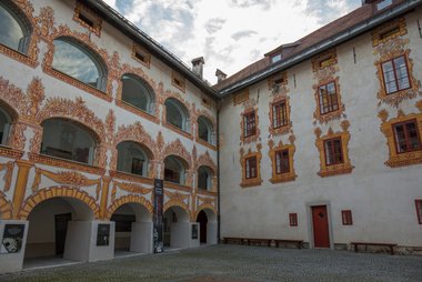
Gewerkenegg Castle was built in the 16th century to store mercury and house the mine offices. Today it holds the town museum, open every day, with displays on mining, lace and local history.
Kamšt Water Wheel is a mine pump from 1790 with a wooden wheel 13.6 m in diameter, the largest preserved wooden water wheel in Europe. You can see it only with a museum guide, booked at the castle museum reception.
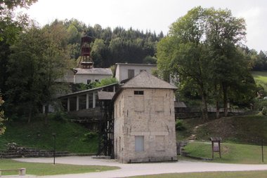
Hg Smelting Plant is the old mercury smelter at the edge of town. Its exhibition explains how ore was turned into liquid metal.
Idrija Lace School has taught Idrija bobbin lace without a break since 1876. It shows its lace collections and has a small shop.
Wild Lake is a small, deep-green spring lake about 2 km south of the centre. Water rises from a flooded cave, and after heavy rain the lake can overflow.
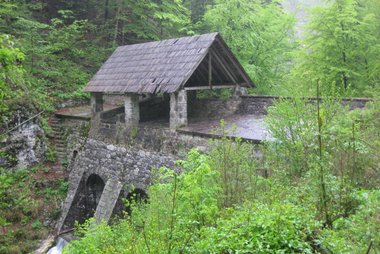
Brusove klavže is one of the Idrija klavže, stone dams built to float timber down to the mine. Their massive walls earned them the nickname "Slovenian pyramids".
Suositellut listat
Mitä kokea
A few things that make a visit to Idrija special:
- Watch lace being made: At Idrija Lace School and during the June festival, lacemakers work with dozens of wooden bobbins at once. Many shops in town sell local lace.
- Walk the Rake water channel: Follow the old mine canal along the Idrijca to the Kobila dam, with a detour to the spring at Wild Lake. It is an easy walk that links nature and mining history.
- Swim in the Idrijca: On hot summer days, locals cool off at the Lajšt bathing area, where the Belca stream meets the Idrijca. From there, a forest road leads to the Brus dam.
- Meet the mine sprite: The legendary Perkmandlc appears on mine tours and gives his name to a festival with music, crafts and food in Advent.
Kierrokset ja aktiviteetit
Idrija — Kartta

Päiväretket
Idrija sits between the Julian Alps, the Soča valley and central Slovenia, so several good day trips are within an hour.
- Franja Partisan Hospital (≈30 min by car): a secret World War II hospital hidden in a narrow gorge near Cerkno. Storms damaged it in 2023, and it is closed for repairs; reopening is planned for spring 2027, so check before you go.
- Postojna (≈50 min by car): Postojna Cave and nearby Predjama Castle, two of the country's most visited sights.
- Škofja Loka (≈1 h by car): one of Slovenia's best-preserved medieval towns, with a castle above the old square.
- Tolmin (≈1 h by car): the Tolmin Gorges and the emerald Soča river, at the edge of Triglav National Park.
- Ljubljana (≈1 h by car or bus): the capital, with its castle, river bridges and compact old town.
Missä vierailla
Idrija lies between the Soča valley in the west and the capital in the east.
- West, towards the Soča valley and the wine country: Tolmin, Nova Gorica and Vipava.
- East, towards central Slovenia: Logatec, Škofja Loka and Ljubljana.
- South, karst caves: Postojna.
Saapuminen
- By air: Ljubljana Jože Pučnik Airport is the nearest airport, about 1 hour away by car. Trieste Airport in Italy is about 1.5 hours away. There is no direct public transport from either airport to Idrija.
- By bus: Regular buses link Idrija with Ljubljana in about 1–1.5 hours, via Logatec. Some buses also run to Cerkno. Arriva bus timetables
- By train: There is no railway to Idrija. The nearest station on the Ljubljana–Koper line is in Logatec, about 30 minutes away by bus or car.
- By car: Leave the A1 motorway at Logatec and follow the winding road through the hills, about 1 hour from Ljubljana.
Liikkuminen paikan päällä
- On foot: The centre is small, and the castle, mine entrance, lace school and Kamšt are all within a 15-minute walk.
- Walking trail: The flat Rake trail follows the old mine water channel from near the bus station to the Kobila dam, about 2.5 km one way. A short side path over a suspension bridge leads to Wild Lake.
- Buses: Local services are few. In the summer school holidays, a free bus runs from town to the Lajšt bathing area on the Idrijca river.
- Cycling: The valley roads are good for cycling, but climbs out of the valley are long and steep.
- More information: Idrija tourist board
Autoilu
- Is a car worth it?: Not for the town itself, which is compact and walkable. A car makes it much easier to reach the klavže dams, the Cerkno area and other places in the hills, as buses are infrequent.
- Parking: Use the car parks by the bus station and the post office, close to the centre and the start of the Rake trail. At Lajšt, parking is charged on summer weekends and holidays.
- Roads: Roads in and out of the valley are narrow and winding. Allow extra time, and watch for cyclists.
Ruoka ja juoma
Idrija's signature dish is idrijski žlikrofi: small, hat-shaped pasta parcels filled with potato, onion and smoked pork fat or herbs. They are protected in the EU as a traditional speciality. They are served as a side dish or main course, often with bakalca, a rich lamb or mutton sauce.
There is no single food street. The best approach is to try žlikrofi at the traditional inns in the old centre and in the villages around town.
Turvallisuus ja terveys
Idrija is a very safe, quiet town, and crime against visitors is rare. The main risks are outdoors:
- Trails: Paths to the klavže dams use forest roads and rough tracks. Wear good shoes, and take care near the water and on wet rocks. Falling rocks are possible along the Idrijca gorge north of the Kobila dam.
- Weather: Heavy rain can cause sudden floods in the narrow valleys. Check the forecast before walking along streams.
- Underground: The mine tour is safe and guided, but it is cool and damp inside, so bring a warm layer.
Historia
Legend says a tub maker found mercury in 1490 while soaking a wooden tub in a spring. The discovery started a mining boom, and Idrija became one of the largest mercury producers in the world. Miners entered the deposit through Anthony's Mine Shaft from 1500, and the mine owners built Gewerkenegg Castle in the 16th century to store mercury and run the business.
The mine needed constant water and timber. Workers built stone dams in the forests to float logs down the rivers, and the Rake channel carried water to Kamšt Water Wheel, which pumped water out of the shafts until 1948. Miners' wives made lace to add to the family income, and the lace school opened in 1876.
Between the two world wars, Idrija belonged to Italy, and remains of Italian forts still stand on the hills. Falling mercury prices made mining unprofitable, and the mine closed in the 1990s. In 2012, Idrija and Almadén in Spain were listed together by UNESCO as the "Heritage of Mercury".
Tietoa maasta
Quick practical facts for Slovenia at a glance:
- Valuutta
- euro EUR · Korttimaksut · Laajasti hyväksytty
- Hätänumerot
- 112
- Sähkö
- 230 V · 50 HzTyyppi C / Tyyppi F
- Kielet
- sloveeni
- Hanavesi
- Juomakelpoista
- Ajosuunta
- Oikea
- Suuntanumero
- +386

Idrija – Suunnittele päiväsi
Muunna tämän oppaan paikat todelliseksi matkasuunnitelmaksi älykkäillä reiteillä, aika-arvioilla ja kaikella, mitä tarvitset onnistuneeseen matkaan.


Liittyvät määränpäät



Data: © OpenStreetMap contributors, Wikidata, Wikipedia, Tripomatic, Official websites, geoBoundaries (CC BY 4.0). Tours by GetYourGuide. We earn commission from bookings. Travel guide generated with AI.
Suunnittele matkasi Tripomaticilla
- Tekoälypohjainen suunnitteluAnna tekoälyn rakentaa matkasuunnitelmasi, vastata matkakysymyksiin ja arkistoida varausasiakirjasi matkaasi.
- MatkustustiedotteetViralliset tiedotteet, vaaralliset säät, lakot ja luonnonkatastrofit matkasi jokaisen päivän paikkoihin.
- Juhlapyhät ja tapahtumatNäe matkasi päiville osuvat lomat, festivaalit ja sulkuajat sekä niiden vaikutus suunnitelmiisi.
- KustannusarvioTekoälypohjaiset matkakustannuserittelyt auttavat sinua hahmottamaan budjetin ennen lähtöä.
- Kierrokset ja liputVaraa kierroksia, jonon ohi -lippuja ja aktiviteetteja suoraan suunnitelmaasi.