


Tây Ninhin maakunta
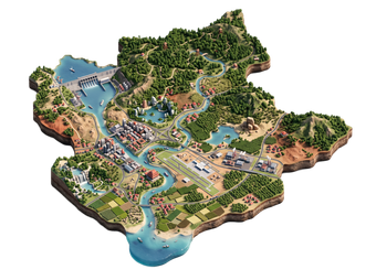
Tây Ninh is a province north-west of Ho Chi Minh City, on the border with Cambodia. It is the home of Caodaism, a religion founded in the 1920s, and its Holy See is a colourful temple complex that draws many visitors. The province also has Núi Bà Đen, the highest mountain in southern Vietnam, with a cable car and a pilgrim site.
Most visitors come on a day trip from Ho Chi Minh City, about 100 km away.

Tây Ninhin maakunta – Suunnitteletko matkaa?
Rakenna päiväkohtainen matkasuunnitelmasi Tripomatic-sovelluksessa.


Milloin matkustaa
November to April is the best time, with dry, sunny weather. May to October is the rainy season, with afternoon storms. The Cao Đài ceremonies at the Holy See take place daily at noon. Núi Bà Đen is busy during Tết and in the first lunar months, when pilgrims climb the mountain.
Päänähtävyydet
- Tòa Thánh Tây Ninh is the main temple of the Cao Đài religion, with bright colours and a mix of Asian and Western styles. Visitors can watch the noon ceremony from the upper gallery.
- Núi Bà Đen is the highest mountain in southern Vietnam, at about 986 metres, with temples on the slopes.
- Khu du lịch Núi Bà Đen is the tourist park at the foot of the mountain, with the cable car and pagodas.
- Gratitude Retribution Temple is a temple area near the Holy See.
Suositellut listat


Mitä kokea
- Watch the noon ceremony: Dress modestly and be quiet. Visitors can watch from the gallery.
- Ride the cable car up Núi Bà Đen: Views over the plains and the lake.
- Climb the mountain: A trail goes up through the temples. Start early.
- Taste local food: Tây Ninh is known for its salt shrimp and rice paper.
Kierrokset ja aktiviteetit
Tây Ninhin maakunta — Kartta

Päiväretket
- Ho Chi Minh City: Ho Chi Minh City is the usual base, about 2 hours by road.
- Cu Chi Tunnels: A war site on the way between the city and Tây Ninh.
- Cambodia: The Mộc Bài border crossing is open to travellers with a visa.
- Cat Tien: Cát Tiên National Park is a longer trip to the north-east.
Missä vierailla
- South-east: Ho Chi Minh City is the main gateway.
- East: Dong Nai has Đồng Nai and nature reserves.
- Delta: Mekong Delta lies to the south-west.
Saapuminen
- By bus: Buses run from Ho Chi Minh City's Miền Tây and Củ Chi stations to Tây Ninh in about 2 hours.
- By tour: Many day tours from Ho Chi Minh City combine the Holy See and Cu Chi Tunnels.
- By car: The drive from Ho Chi Minh City takes about 2 hours.
- By train and air: There is no railway or airport. Vietnam Railways
Liikkuminen paikan päällä
- Taxi and ride-hailing: Available in Tây Ninh city.
- Motorbike hire: Easy to rent, and the best way to reach the mountain.
- Cable car: Runs up Núi Bà Đen from the tourist park.
- Walking: The Holy See complex is easy to walk around.
Autoilu
- Is a car worth it? A car with a driver is a good option for a day trip from Ho Chi Minh City.
- Roads: Highway 22 is busy near the city.
- Parking: Free at the Holy See. Paid at the mountain.
Ruoka ja juoma
Tây Ninh food has simple local ingredients. Try muối tôm, salted shrimp with chilli, bánh tráng phơi sương, soft rice paper, and bánh canh Trảng Bàng, a thick noodle soup. Vegetarian food is common near the Cao Đài temples.
Turvallisuus ja terveys
Tây Ninh is safe for visitors.
- Dress modestly at the Holy See: cover your shoulders and knees.
- Do not take photos in the main hall during the ceremony.
- The climb up the mountain is hot and steep. Bring water.
- If you cross to Cambodia, carry your passport and visa.
- Protect against mosquitoes in the rainy season.
Historia
Caodaism was founded in Tây Ninh in 1926 and blends elements of Buddhism, Confucianism, Taoism and Christianity. The Holy See was built in the 1930s as the centre of the faith and the base of a religious state.
The province was heavily fought over in the Vietnam War because of its border with Cambodia. Today it is a quiet province known for its pilgrim sites.
Tietoa maasta
Quick practical facts for Vietnam at a glance:
- Valuutta
- Vietnamin dong VND ₫ · Korttimaksut · Yleisesti hyväksytty
- Sähkö
- 220 V · 50 HzTyyppi A / Tyyppi C / Tyyppi F
- Kielet
- vietnam
- Hanavesi
- Ei juomakelpoista
- Ajosuunta
- Oikea
- Suuntanumero
- +84
Tây Ninhin maakunta – Suunnittele matkasi
Valitse paikat, jotka haluat nähdä, ja Tripomatic muuntaa ne päiväkohtaiseksi reitiksi älykkäiden reittien, aika-arvioiden ja muiden täydellisen matkan ominaisuuksien kera.


Liittyvät määränpäät



Data: © OpenStreetMap contributors, Wikidata, Wikipedia, Tripomatic, Official websites, geoBoundaries (CC BY 4.0). Tours by GetYourGuide. We earn commission from bookings. Travel guide generated with AI.
Suunnittele matkasi Tripomaticilla
- Tekoälypohjainen suunnitteluAnna tekoälyn rakentaa matkasuunnitelmasi, vastata matkakysymyksiin ja arkistoida varausasiakirjasi matkaasi.
- MatkustustiedotteetViralliset tiedotteet, vaaralliset säät, lakot ja luonnonkatastrofit matkasi jokaisen päivän paikkoihin.
- Juhlapyhät ja tapahtumatNäe matkasi päiville osuvat lomat, festivaalit ja sulkuajat sekä niiden vaikutus suunnitelmiisi.
- KustannusarvioTekoälypohjaiset matkakustannuserittelyt auttavat sinua hahmottamaan budjetin ennen lähtöä.
- Kierrokset ja liputVaraa kierroksia, jonon ohi -lippuja ja aktiviteetteja suoraan suunnitelmaasi.