


Mayrhofen
Mayrhofen is the main village of the Zillertal in Tyrol, at the end of a narrow valley surrounded by the Zillertal Alps. It is a resort for skiing in winter and hiking in summer, with a lively centre.
The village is the end of the Zillertalbahn, a narrow-gauge railway that runs up the valley from Jenbach. Nearby, the Hintertux Glacier offers year-round skiing.

Mayrhofen – Tu prépares un voyage ?
Crée ton itinéraire jour par jour dans l'application Tripomatic.


Quand partir
December to April is ski season, with the Hintertux Glacier open all year. June to September is best for hiking and cable car trips. April–May and October–November are quiet. Winters are cold and snowy. Summers are mild.
Sites incontournables
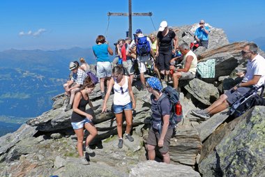

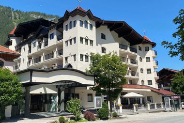
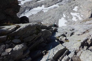
- Mayrhofen is the village centre, with a main street, church and cafes.
- Panoramaplattform Zillertal is a viewing platform with a view into the Zillertal.
- Adlerbühne is the setting for bird of prey shows at the Ahorn.
- Ahornspitze is a peak above the village and a popular summit hike.
- Schwarzsee is a small lake in the Zillertal Alps, reached on a day hike.
- Berliner Hütte is a mountain hut on the Berliner Höhenweg, a classic multi-day trail.
- Erlebnissennerei Schau-Bauernhof is a farm and cheese dairy where you can see how mountain cheese is made.
- Erlebnisbad Mayrhofen is a swimming pool complex for hot days.
- Zsigmondyspitze is a peak for experienced alpine hikers.
Listes recommandées

Expériences à vivre
- Ride the Penken and Ahorn cable cars.
- Ski the Hintertux Glacier at any time of year.
- Take the steam railway up the valley.
- Hike to a mountain hut.
- Try canyoning in the Zillertal.
Visites et activités
Mayrhofen — Carte

Excursions à la journée
- Tux is the valley of the Hintertux Glacier, about 30 minutes by car or bus.
- Strass im Zillertal is on the valley floor, about 20 minutes by train.
- Innsbruck is about 1 hour 15 minutes by train and bus.
- Kitzbühel is about 1 hour 30 minutes by car.
- Krimml Waterfalls, among Europe's tallest, are about 1 hour 15 minutes by car.
Où s'aventurer
- Tux and Strass im Zillertal are the closest preferred places in the Zillertal.
S'y rendre
- By air: Innsbruck Airport is about 1 hour 15 minutes by road. Munich and Salzburg are the other options.
- By train: The Zillertalbahn runs from Jenbach to Mayrhofen in about 1 hour. Jenbach is on the main Innsbruck–Munich line. Check times on ÖBB.
- By car: Take the A12 motorway to Zillertal and then the B169 road up the valley.
Se déplacer
The village is small and walkable. Ski buses and local buses run through the valley. Cable cars leave from the village. Guest cards usually include local transport in summer.
Conduite
A car is helpful for the side valleys and the Zillertal Alpine Road. Winter tyres or chains are required in snow. Parking in the village is metered. Motorways in Austria need a vignette.
Gastronomie
Zillertal food includes Zillertaler Krapfen, cheese-filled pastries, and Kasspatzln. Dairy farms make mountain cheese. Many huts serve simple dishes, and local beer is brewed in the valley.
Sécurité et santé
Mayrhofen is safe. Mountain weather changes quickly. Check forecasts and avalanche bulletins before going up. Tap water is clean and safe to drink. The emergency number is 112. The mountain rescue number is 140.
Histoire
The Zillertal was settled by farmers and miners. The railway arrived in 1902 and brought tourism. Mayrhofen grew into a leading resort in the 20th century and the Hintertux Glacier lifts followed.
Infos pays
Quick practical facts for Austria at a glance:
- Devise
- euro EUR € · Paiements par carte · Couramment acceptées
- Numéros d'urgence
- 112
- Électricité
- 230 V · 50 HzType C / Type F
- Langues
- allemand
- Eau du robinet
- Potable
- Sens de conduite
- À droite
- Indicatif téléphonique
- +43


Mayrhofen – Planifie tes journées
Transforme les lieux de ce guide en un véritable itinéraire, avec des itinéraires intelligents, des estimations de temps et tout ce dont tu as besoin pour un voyage parfait.


Destinations associées

Data: © OpenStreetMap contributors, Wikidata, Wikipedia, Tripomatic, Official websites, geoBoundaries (CC BY 4.0). Tours by GetYourGuide. We earn commission from bookings. Travel guide generated with AI.