


Province de Ninh Thuan
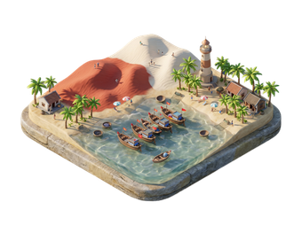
Ninh Thuận is a dry coastal province in south-central Vietnam, between Nha Trang and Phan Thiết. It is one of the driest places in the country. The coast has quiet bays at Vĩnh Hy and Bình Tiên, and the inland has red sand dunes and Cham towers. Phan Rang–Tháp Chàm is the main town.
Most visitors come for a day or two from Nha Trang or Da Lat.

Province de Ninh Thuan – Tu prépares un voyage ?
Crée ton itinéraire jour par jour dans l'application Tripomatic.


Quand partir
The dry season from January to August suits the beaches, though it is hot. Rain falls between September and December and is light compared with other provinces. The sea is calm from March to September.
Meilleure période pour visiter: janvier, février
Sites incontournables
- Tháp Porome is a Cham tower complex near Phan Rang, still used for ceremonies.
- Hang Rái is a rocky cove in Vĩnh Hy with clear water for swimming and snorkelling.
- Vĩnh Hy Bay is a sheltered bay with a small fishing community.
- Nam Cương dunes is a field of red and white sand dunes near the coast.
- Bãi Cà Tiên is a small beach with calm water.
- Big Rock is a large boulder on the coast near Vĩnh Hy.
- Hòn Đỏ is a red rock outcrop on the shore.
Po Klong Garai, a 13th-century Cham temple on a hill near Phan Rang, is the best-known tower in the province.
Expériences à vivre
- Swim and snorkel at Vĩnh Hy: Clear water and quiet coves.
- Walk the dunes at sunrise: Cooler and better light.
- Visit a Cham tower: Some are still used for worship.
- Watch salt and shrimp farms: These line the coast near Phan Rang.
- Eat fresh seafood: Grilled shrimp and fish at small restaurants.
Visites et activités
Province de Ninh Thuan — Carte

Excursions à la journée
- Nha Trang: Nha Trang is about 2 hours north by road.
- Da Lat: Da Lat is about 3 hours inland on the mountain road.
- Binh Thuan: Bình Thuận lies to the south.
Où s'aventurer
S'y rendre
- By train: Tháp Chàm station is on the north–south line. Vietnam Railways
- By road: Highway 1 runs through Phan Rang. Buses from Nha Trang take about 2 hours.
- From Da Lat: The mountain road over Ngoạn Mục Pass takes about 3 hours.
- By air: The nearest airport is Cam Ranh, about 60 km north.
Se déplacer
- Motorbike hire: Best for the coast road to Vĩnh Hy.
- Taxi: Available in Phan Rang.
- Car with driver: Useful for a day trip to the coast and the dunes.
Conduite
- Is a car worth it? Yes, for the coast road and the dunes.
- Roads: Highway 1 is busy and flat. The coast road to Vĩnh Hy has bends and views.
- Heat: Summer midday heat is strong. Start early.
Gastronomie
Ninh Thuận is known for its dry-climate produce. Try grapes, grilled lamb and goat, and seafood such as lobster and shrimp. A local dish is bánh canh chả cá, a thick noodle soup with fish cake. Cham communities add their own dishes and weaving traditions.
Sécurité et santé
Ninh Thuận is safe for visitors.
- The province is hot and dry. Drink water and use sun protection.
- Swim only in calm water. Currents can be strong at open beaches.
- Dunes have no shade. Bring a hat.
- Wear a helmet if you hire a motorbike.
Histoire
Ninh Thuận was part of the Champa kingdom, which built brick towers across central Vietnam. The area around Phan Rang was one of the last Cham centres and still has a large Cham population.
The Vietnamese took over the region in the 17th century. Cham towers, weaving and festivals remain in use today.
Infos pays
Quick practical facts for Vietnam at a glance:
- Devise
- dông vietnamien VND ₫ · Paiements par carte · Couramment acceptées
- Électricité
- 220 V · 50 HzType A / Type C / Type F
- Langues
- vietnamien
- Eau du robinet
- Non potable
- Sens de conduite
- À droite
- Indicatif téléphonique
- +84
Province de Ninh Thuan – Planifie ton voyage
Choisis les lieux que tu veux voir et Tripomatic les transforme en un itinéraire jour par jour, avec des itinéraires intelligents, des estimations de temps et tout ce dont tu as besoin pour un voyage parfait.


Destinations associées

Data: © OpenStreetMap contributors, Wikidata, Wikipedia, Tripomatic, Official websites, geoBoundaries (CC BY 4.0). Tours by GetYourGuide. We earn commission from bookings. Travel guide generated with AI.